Catalog Archive
Auction 179, Lot 717

"Carte de la Colchide Appelee Maintenant Megrelie et par Ceux du Pays, Odisci", Thevenot, Melchisedech
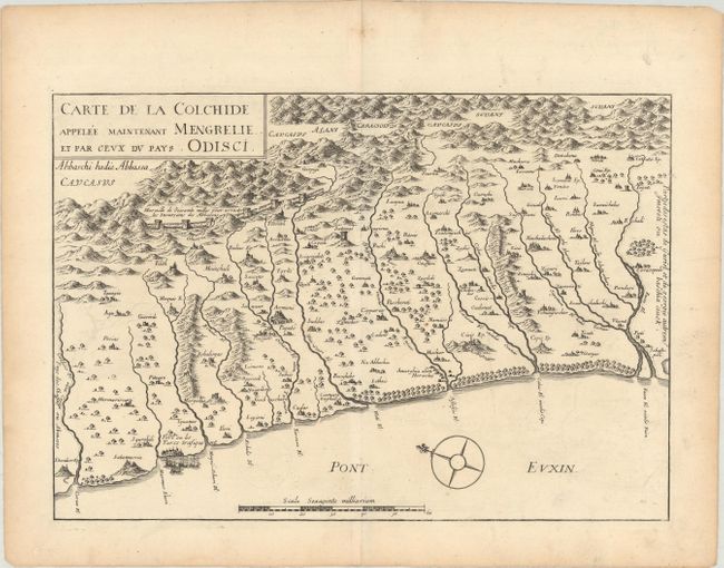
Subject: Caucasus

Period: 1663 (circa)

Publication: Relations de Divers Voyages Curieux

Color: Black & White

Size:
15.3 x 10.6 inches
38.9 x 26.9 cm
Download High Resolution Image
(or just click on image to launch the Zoom viewer)

A simple yet attractive map showing the Caucasus region along the eastern shore of the Black Sea. The map presents pictorial representations of villages and towns, forests, rivers, and mountains with the Kelasuri Wall prominently depicted in the background. A compass rose in the sea indicates north is oriented to the top left.

References: Shirley (BL Atlases) G.THEV-1a #1.

Condition: A

On a watermarked sheet with a hint of offsetting.

Estimate: $150 - $180

Sold for: $100

Closed on 9/16/2020

Archived