Subject: Persia - Iran
Period: 1680-1793 (circa)
Publication:
Color: Hand Color
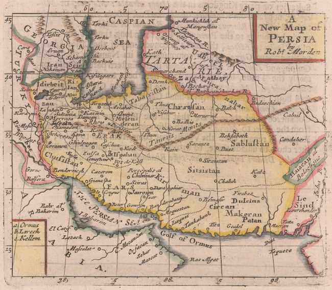
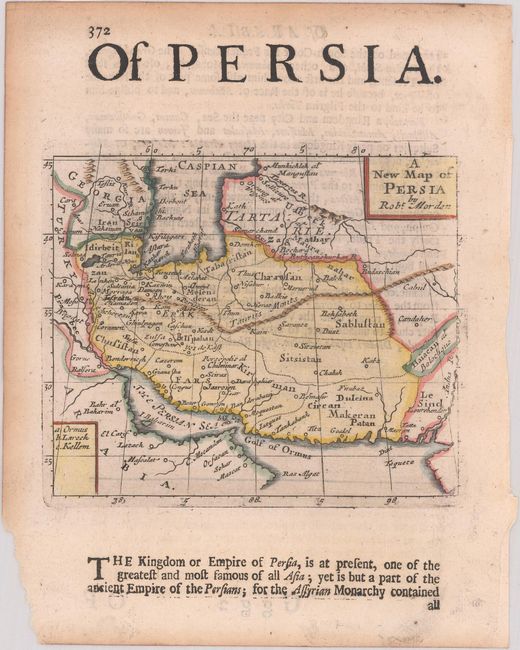
A. A New Map of Persia, by Robert Morden, from Geography Rectified, circa 1693 (5.3 x 4.4"). This small map of Persia extends to include parts of present-day Georgia, Armenia, Azerbaijan, Iraq, Turkmenistan, Afghanistan, and the Arabian Peninsula. It identifies political divisions and cities and includes some topographical detail. A key at bottom left names three small islands near the Strait of Hormuz: Ormus, Lareck, and Kellem. Reference: King (2nd ed) pp. 148-49; Shirley (BL Atlases) T.MORD-2a #27. Condition: On watermarked paper with minor show-through of text on verso. There is light toning along the edges, well away from map image, a chip at bottom left, and remnants of hinge tape on verso.
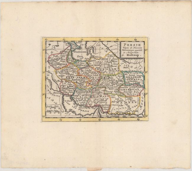
B. Persie Volgens de Nieuwste Waarnemingen Opgeteld, by Willem Holtrop, from Zak-Atlas of Leidsman des Reizigers, circa 1793 (4.9 x 3.9"). This detailed miniature map is from a little-known Dutch cartographer whose maps rarely appear on the market. It includes nice topographical detail for a map of its size. The map delineates political divisions and names several towns and cities, including Isfahan, Shiraz, Basrah, Kandahar, and the ancient city of Susa. Two distance scales appear at bottom left, and a simple title cartouche adorns the top right corner. Reference: Shirley (BL Atlases) T.HOLT-1a #27. Condition: On a sheet with a coat of arms watermark and wide margins.
References:
Condition: A
See description above.