Subject: Middle East
Period: 1747-1810 (circa)
Publication:
Color: Black & White
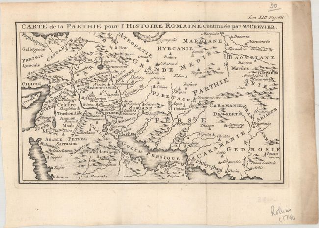
A. Carte de la Parthie pour l'Histoire Romaine Continuee par Mr. Crevier, by Jean-Baptiste Louis Crevier, from Histoire Romaine Depuis la Fondation de Rome, published 1747 (8.3 x 5.1"). This attractive map of the Parthian Empire was published in Crevier's continuation of Charles Rollin's Roman history. It shows ancient place names and nice topographical detail. Condition: Issued folding on paper with a coat of arms watermark, some minor offsetting, and heavy soiling along the right edge of the sheet. (A)
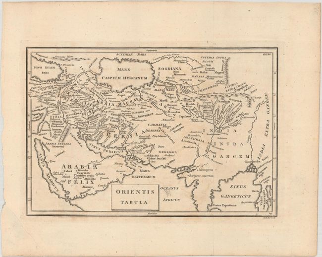
B. Orientis Tabula, by Benjamin Baker, circa 1810 (8.1 x 5.4"). This handsome map covers from the Black Sea, Turkey, Cyprus, and the Red Sea across the Middle East to the Ganges River. It includes ancient place names and features a horizontally-shaped Caspian Sea. Condition: Issued folding on paper with a "1796" watermark. There is light offsetting, faint foxing, and a tear in the bottom left blank margin that has been closed on verso with paper tape. (B+)
References:
Condition:
See description above.