Subject: Czech Republic
Period: 1716 (circa)
Publication: Neuer Atlas uber die Gantze Welt
Color: Hand Color
Size:
22.9 x 19.1 inches
58.2 x 48.5 cm
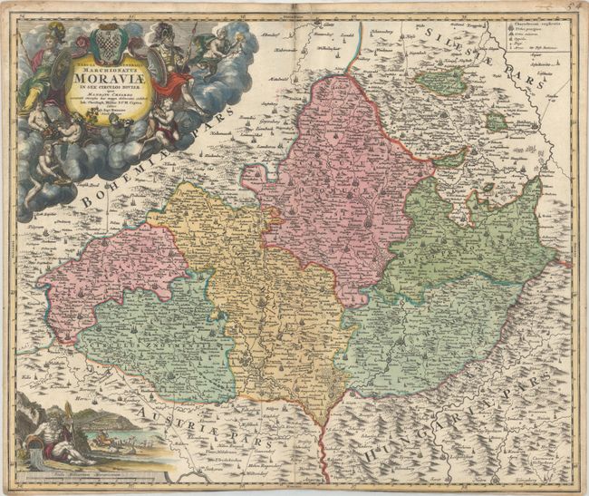
Handsome map of Moravia, the southeastern part of the Czech Republic, showing its six political divisions. The major cities are Brno (Brunn) and Olomouc (Olmutz), and there are hundreds of other cities and villages located. The map is beautifully engraved and embellished with a very decorative cartouche composed of allegorical figures and a coat-of-arms. In the lower left, a pastoral scene with a river god adorns the distance scale.
References:
Condition: B+
Contemporary color in the map with later color in the cartouches, minor soiling, and faint damp staining along the top edge of the sheet. There is a long centerfold separation at bottom that has been professionally repaired with old paper on verso. Trimmed at bottom by the bookbinder with partial loss of the neatline.