Subject: Low Countries
Period: 1672 (dated)
Publication:
Color: Hand Color
Size:
22.5 x 17.3 inches
57.2 x 43.9 cm
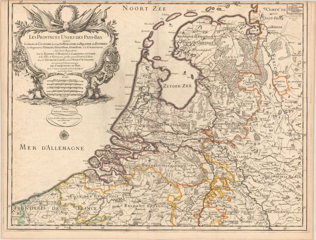
This elegantly engraved map of the United Provinces of the Netherlands extends to include parts of France, Belgium, and Germany. The map stretches along the coast from Calais to Emden and covers as far east as Cloppenburg. It locates towns and cities, political boundaries, mountains, marshes, and rivers. There is an elaborate title cartouche that dominates that top left corner, complete with various coats of arms, distance scales, symbols of military strength, and allegorical figures. A compass rose appears beneath the title cartouche in the Mer d'Allemagne. The map is dated 1672 in the title cartouche, but a manuscript note at top right reads "Chez l'autheur aux Galleries du Louvre 1681."
References:
Condition: B+
Contemporary outline color on a sheet with an "I. LEBLOYS" watermark. There are some minor spots, printer's ink residue, and faint offsetting. The upper neatline was trimmed away by the bookbinder.