Subject: Norway
Period: 1720 (circa)
Publication:
Color: Hand Color
Size:
19.9 x 23.4 inches
50.5 x 59.4 cm
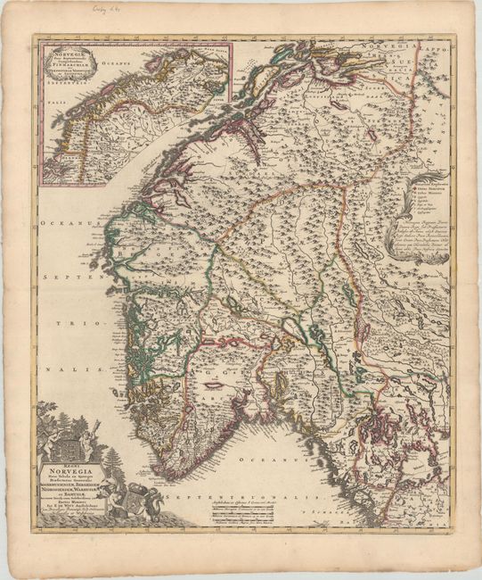
This beautifully engraved map of Norway features political divisions, towns and cities, topographical detail, and exquisite detail of the fjords and coastal islands. The southern part of the country is the focus of the main map. An inset at top left details the northern part of the country and includes its own decorative title cartouche. A key appears at right inside a decorative cartouche. There is an impressive title cartouche at bottom left depicting merfolk pulling the Norwegian coat of arms out of the ocean, two putti with the state coat of arms of Denmark, and trees. Johann Baptist Homann based his map of Norway on de Wit's map. This is a later edition of the map, published by Covens & Mortier.
References: cf. Ginsberg (Scandia) #55.
Condition: A
A dark impression with contemporary outline color.