Subject: Scotland
Period: 1794 (dated)
Publication:
Color: Hand Color
Size:
20.9 x 24.5 inches
53.1 x 62.2 cm
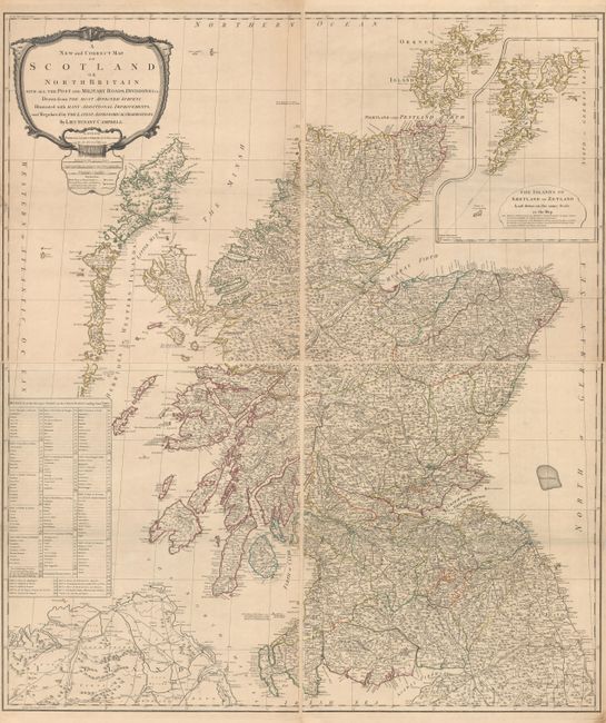
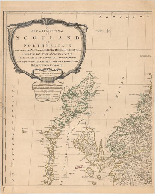
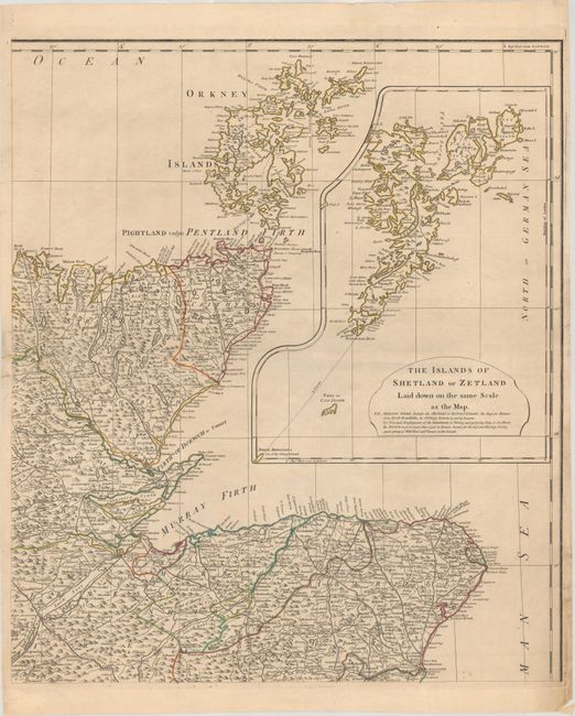
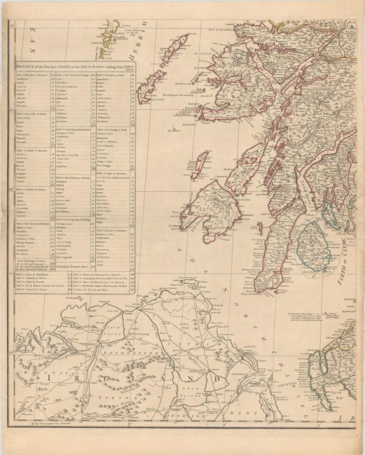
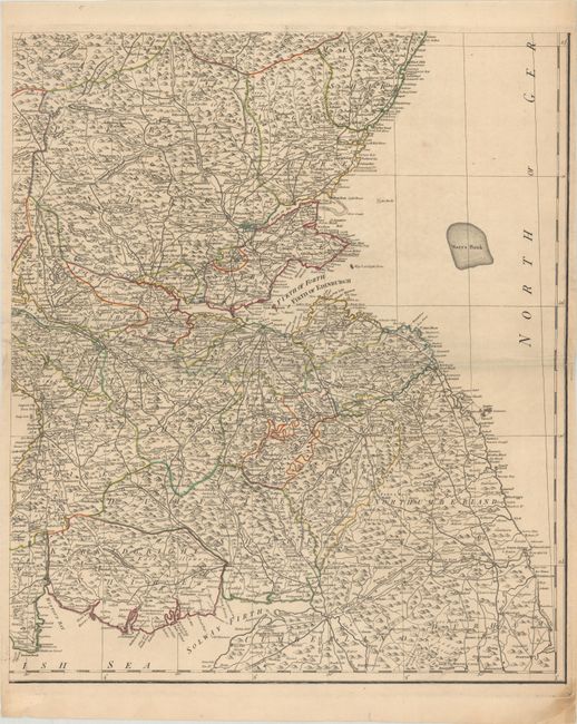
This handsome and exquisitely detailed four-sheet wall map of Scotland is by Admiral Surveyor Lieutenant Robert Campbell. It is based on Marcus Armstrong's 1782 map, which was revised and reissued by Robert Sayer in 1790; this is the later reissue by Laurie and Whittle. The map is divided into counties and identifies many towns and cities. A key beneath the title cartouche identifies market and borough towns and military roads. There is excellent topographical detail of the lochs, rivers, and mountains. A large inset on the northeast sheet focuses on the Shetland Islands, depicting them on the same scale as the rest of the map. On the southwest sheet, there is a table that notes the distances of the stage routes leading from Edinburgh. An ornate title cartouche adorns the top left corner of the northwest sheet.
References: Moir, p. 203.
Condition: B+
A crisp impression with contemporary outline color. There are minor spots and short edge tears at right and left on each sheet that have been repaired with archival materials on verso. The first image is a composite image - the map is in four separate sheets.