Subject: Northwestern England
Period: 1695 (circa)
Publication: Camden's Britannia
Color: Hand Color
Size:
16.6 x 14.3 inches
42.2 x 36.3 cm
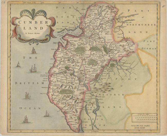
This handsome map of the historic county of Cumberland in northwestern England identifies rivers, castles, forests, parks, and major cities such as Carlisle, which was a prominent Roman settlement as early as the 1st century. Hadrian's wall, or The Picts Wall, is shown above Carlisle, and six ships appear in in the British Ocean off the western coast. An inscription at the bottom indicates that the map was sold by Abel Swale, Awnsham and John Churchill.
Morden was one of the first English cartographers to show longitudes measured from the meridian of St. Paul's Cathedral (shown in degrees at the bottom of the map) and time in minutes measure locally from the sun (shown at the top). The roads on his maps are based on Ogilby's earlier survey. The Britannia was first published by historian William Camden (1551-1623) in 1586. After the publication of the final edition of Britannia in 1637, the work was not published again until 1695 when Gibson revised and translated the text from the original Latin and included fifty maps, mostly of the English counties, prepared by Robert Morden, replacing the outdated maps of Christopher Saxton.
References: Shirley (BL Atlases) T.CAMD-5a.
Condition: B+
A crisp impression on a sheet with a large horse watermark, light toning, and minor soiling. The top margin is narrow, as issued, and there is an archivally-repaired short tear that enters less than 1" into image at top.