Subject: Britain, Atlas
Period: 1610 (published)
Publication:
Color: Black & White
Size:
9 x 13.3 inches
22.9 x 33.8 cm
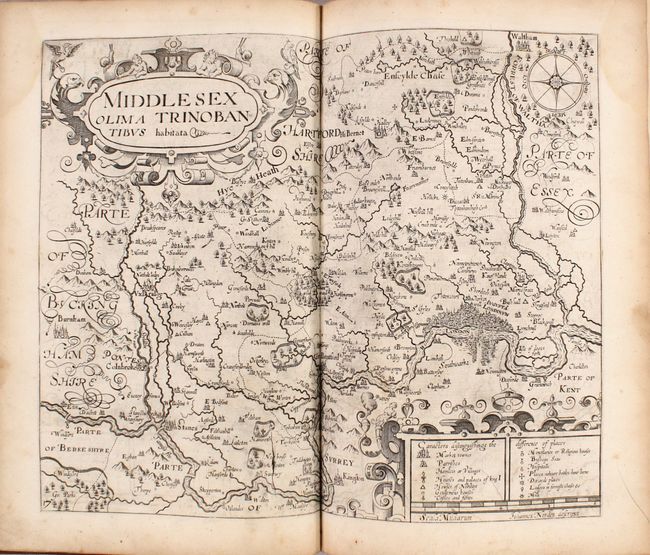
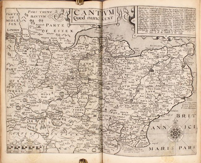
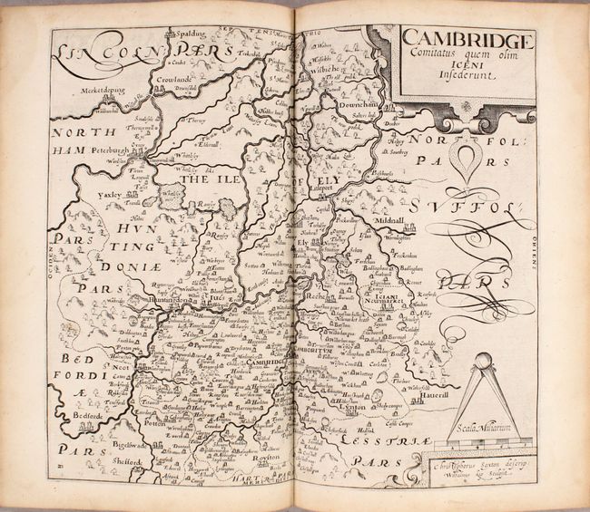
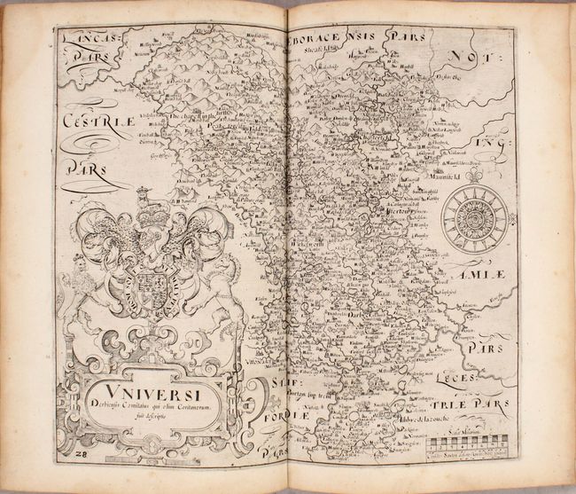
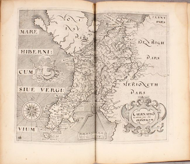
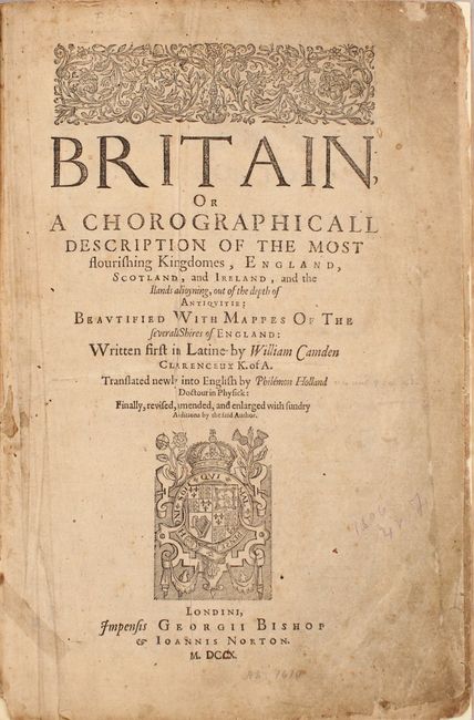
This is the first edition of Camden's Britannia with English text, translated from Latin by Philemon Holland, and the second of only three editions with county maps by William Kip and William Hole. The majority of the maps are based on Christopher Saxton's monumental survey of England and Wales. This example contains all of the original 57 maps including the maps of England and Wales, Scotland, and Ireland. Each map is finely engraved with handsome embellishments, such as elaborate title cartouches, large compass roses, and decorative distance scales. All of the maps are double-page with the exception of the maps of Rutlandshire and Anglesey, which are single-page. In addition to the maps are eight plates of coins of the Romans and Britons, as well as a number of additional engravings and diagrams within the text.
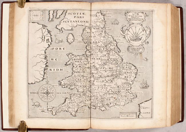
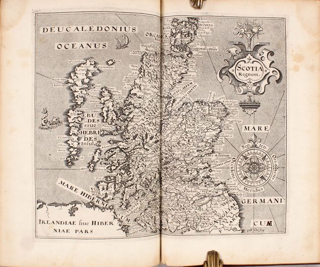
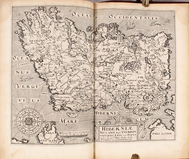
The three most important maps in the volume were engraved by William Hole. The map of England and Wales, Englalond Anglia Anglosaxonum Heptarchia, depicts the traditional Anglo-Saxon kingdoms. It includes a superb compass rose, two ships, three sea monsters, and a large and ornate title cartouche featuring the seven-scepter symbol of the Heptarchy. The map of Scotland, Scotia Regnum, is based on Mercator's 1595 map. The map extends to include the Hebrides Islands and a portion of the Orkney Islands, and is filled with place names and strong topographical features. The map is richly embellished with a strapwork title cartouche, elaborate compass rose, sea monster, sailing ship, and a stippled sea. The map of Ireland, Hiberniae Ireland Anglis, is also based closely on Mercator's map of 1595, and is divided into counties with fair detail of mountains, forests, rivers, lakes and towns. It is richly ornamented with a strapwork title cartouche, ships, sea monsters in a stippled sea, and an elaborate compass rose.
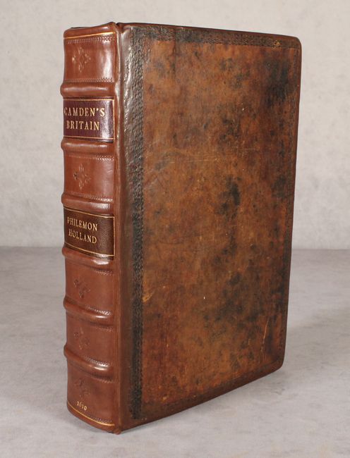
Leaves 1 (frontispiece), 2 and 7 have been replaced with facsimile copies from a volume in the British Museum. The last 8 leaves of the index are missing, which included the indexes for Scotland and Ireland, as well as "The Names of Severall Nations, Cities…of Britaine in Old Time." Small folio; 57 maps; 8 plates of coins; 822 pp.; 233 pp. (separate section on Scotland); index. Full leather with original boards with decorative tooling; new spine based on the style of the original with raised bands, tooling, and gilt title labels; new endpapers.
References: Shirley (BL Atlases) T.CAMD-1b.
Condition: B+
The maps are in near fine (A) or very good (B+) condition, with occasional soiling, toning, printer's ink residue, short fold separations at bottom, and damp stains entering the top corners of several maps. The map of Buckinghamshire has a short tear near the center of the map. There are also a few short tears and old manuscript notations in the text. The title page and first few leaves of the "To the Reader" section are moderately toned and soiled with some small chips and tears. A previous owner has erroneously added an extra "C" in ink within the date on the title page, making the date appear as "1710." Three missing leaves (1, 2, and 7) have been replaced with facsimile copies. The volume was handsomely restored using the original covers, which are well worn with bumped corners. The new spine is pristine.