Subject: Europe
Period: 1833 (dated)
Publication:
Color: Hand Color
Size:
28 x 19.3 inches
71.1 x 49 cm
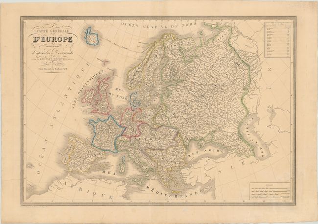
This large map is filled with great detail of cities, roads, and rivers throughout Europe. There are interesting political boundaries, with the Austrian Empire encompassing much of central and eastern Europe, with Germany and the Kingdom of Prussia to the north, and the Balkans forming part of the Ottoman Empire. A table at top right provide distances between Paris and the capitals of countries throughout Europe. Keyboard style border. Published by Dubreuil.
References:
Condition: B+
Contemporary outline color on heavy paper with a "D J" watermark. There is light toning, minor soiling, a few minute holes, and a faint damp stain at bottom right.