Subject: Brazil
Period: 1732 (circa)
Publication: A Collection of Voyages and Travels
Color: Black & White
Size:
14.1 x 11.3 inches
35.8 x 28.7 cm
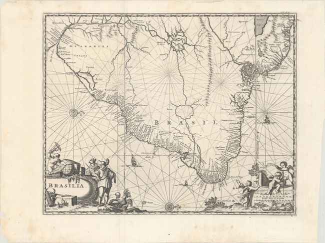
Excellent map of the eastern part of Brazil based on the cartography of Hessel Gerritsz and an earlier map by Blaeu. There is extensive detail in the coastal regions with the interior left largely blank except for some conjectural river systems, including the mythical Parime Lago in Guiana and Xarayes Lago in Brazil. The Linea Aequinoctialis is prominently shown dividing the Spanish and Portuguese colonial claims. The map is richly embellished with rhumb lines, compass roses, and sailing ships. European traders, Indians, and putti surround the title and scale of miles cartouches. This map was originally created by Arnoldus Montanus in 1671; the same plate was later used by Olivier Dapper, John Ogilby, Pierre van der Aa, and then John Churchill.
References: Shirley (BL Atlases) G.CHUR-1a #5.
Condition: A
A crisp impression on a bright sheet with some minor extraneous creasing at top, marginal soiling, and a few tiny chips at bottom left.