Subject: Western United States & Mexico
Period: 1828 (dated)
Publication:
Color: Hand Color
Size:
11.9 x 8.9 inches
30.2 x 22.6 cm
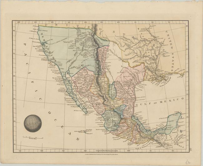
A detailed map covering the region from California to the Yucatan peninsula with additional detail around the Mississippi River basin. It presents the political divisions of Mexico, which include San Luis Potosi (no Texas), New Mexico, Sonora, and (Baja) California. The region between New Mexico and San Luis Potosi is void of name or detail, and the Great Basin region is virtually blank with the exception of a "reported communication" linking Lake Timpanogos to the Pacific Ocean. The title is emblazoned onto a globe as an interesting decorative element.
References:
Condition: A
A nice impression on a clean sheet.