Subject: Southwestern United States & Mexico
Period: 1847 (dated)
Publication:
Color: Hand Color
Size:
23.6 x 32 inches
59.9 x 81.3 cm
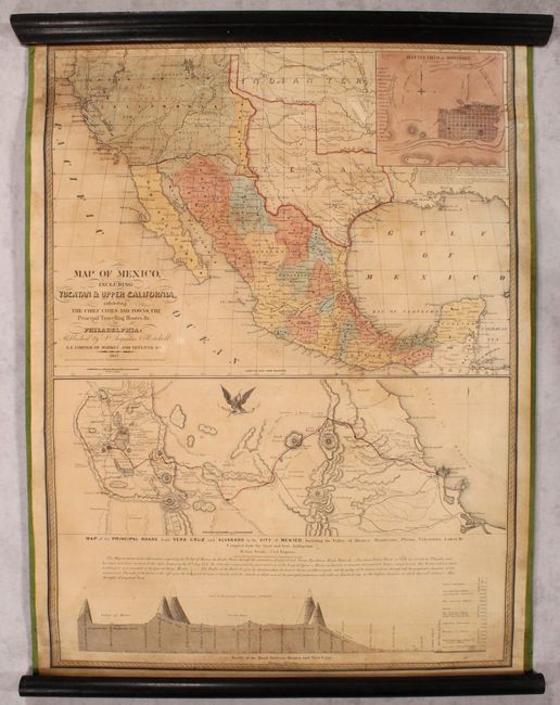
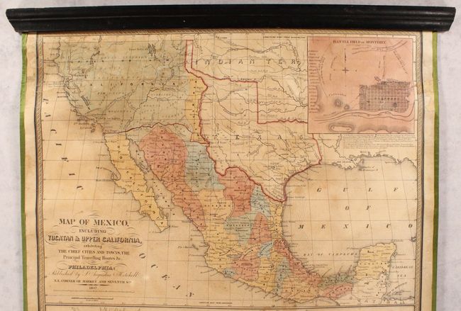
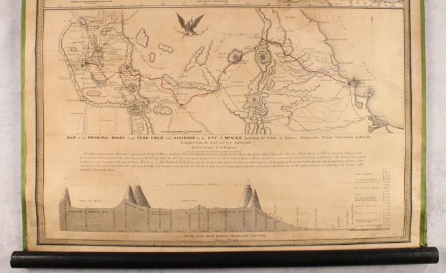
This is the second edition of Mitchell's important map showing the progress of the Mexican-American War. This edition is revised with additional place names and significantly enlarged to include the "Map of the Principal Roads from Vera Cruz and Alvarado to the City of Mexico," the corresponding elevation profile below it, and an updated inset map showing the "Battle Field at Monterey." The map is considered to be an adaptation of Mitchell's earlier A New Map of Texas Oregon and California.
Cartographically, the map presents Texas in its large stovepipe configuration with it southern boundary on the Rio Grande. To its west is the narrow New Mexico and vast Upper California with a red line along the Gila River, implying U.S. control of this region as the map was published after victories by Commodore Sloat (California) and General Kearny (New Mexico/California). In California, Yerba Buena and New Helvetia are identified, and several important routes are noted including the Great Spanish Trail to Santa Fe and the Trader's Route to Independence, Mo. The map also indicates six battle sites with small flags including Palo Alto, Resaca de la Palma, Monterey, Buena Vista, Cerro Gordo, and Vera Cruz. Being a wartime map, Mitchell chose to emphasize lines of communication, settlements, and political boundaries and less so on topographical features. Decorated by fancy titling with flourishes.
Professionally restored with new linen backing and edge ribbon on original rollers.
References: Streeter Sale #3869; TX GLO pp. 218-219; Wheat (Gold) #35.
Condition: B+
An attractive example that has benefited from professional conservation. The map has been backed with new linen to reinforce and repair numerous small cracks and tears mostly at top. There are two small areas of loss below Great Salt Lake that have been reinstated in facsimile, along with two small chips in the left and right border also replaced in facsimile. Overall pleasant light toning and minor foxing.