Subject: United States, Mexico, & Central America
Period: 1844 (circa)
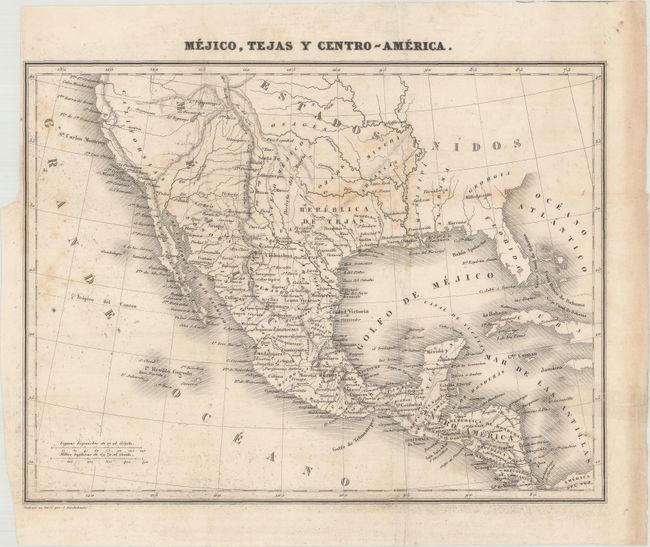
Publication: Nuevo Curso Completo de Geografia…
Color: Black & White
Size:
10.2 x 7.7 inches
25.9 x 19.6 cm
This rare and finely engraved map names the Republica de Tejas (Republic of Texas). This example was originally published in Sanchez de Bustamante's Nuevo Curso Completo de Geografia Universal... para Uso de los Nuevos Estados Americanos, con un Resumen Preliminar de Geografia Antigua y Sagrada. Although much of the map's geography is accurate, Austin is located east of the Brazos River, north of present-day Houston. The map also locates Galveston, Bejar (later San Antonio), El Paso, and Tinoxtitlan, twice proposed as the capital of Texas in the 1830s. In the Great Basin, two speculative rivers connect L. Timpanogos and L. Teguayo to the Pacific Ocean.
References:
Condition: B+
Issued folding with light scattered foxing, an extraneous crease, and minor soiling. An edge tear in the right blank margin has been closed on verso with tape.