Subject: Washington
Period: 1855 (dated)
Publication:
Color: Black & White
Size:
19.4 x 14.6 inches
49.3 x 37.1 cm
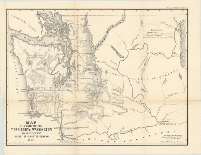
This uncommon map was executed by James Tilton, Surveyor General, from the Olympia office. This is the first GLO map of Washington Territory, issued just 28 months after its creation. The map shows limited survey progress with modest detail west of the Cascades. In the east, only major rivers are shown. Several forts (Steilacom, Nisqually, Walla Walla, and Townsend) are located, and Seattle is labeled Statle. The legend at upper right identifies surveyed lines, surveys under progress, townships subdivided, and proposed surveying for the 1856 & 57 season. This historical and infrequently offered map is well-drawn on a scale of 1"=18 miles.
References:
Condition: A
Issued folding on a clean sheet with a binding trim at lower left.