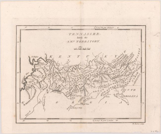
Subject: Tennessee
Period: 1801 (published)
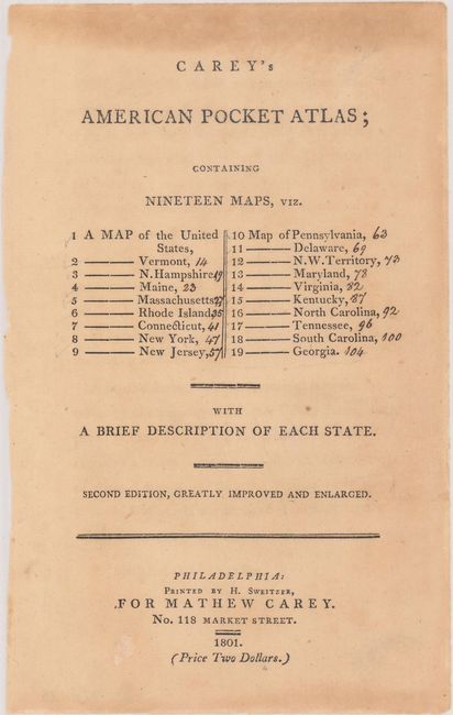
Publication: Carey's American Pocket Atlas
Color: Black & White
Size:
7.7 x 5.8 inches
19.6 x 14.7 cm
Mathew Carey was a seminal figure in early American publishing; establishing the first publishing firm to specialize in cartography and issuing the first atlas devoted exclusively to American maps. He set up an elaborate cottage system of craftsmen for compiling, engraving, printing, and coloring maps. This practice was emulated by later American cartographic publishers such as John Melish and Henry S. Tanner. The American Atlas concept was also adopted by other publishers in both the United States and Europe.
This is the second state of this early map of Tennessee. First issued in 1796, this version has been updated with important roads reflecting the rapid settlement throughout the young state -- the country's western frontier at the beginning of the nineteenth century. The map also shows rivers, some topography, and a few villages though the northeastern corner of the state has been placed too far to the east.
This lot includes the title page from the atlas.
References: Wheat & Brun #652.
Condition: A
A nice impression on a clean sheet. Additional title page is lightly toned.