Subject: Hawaii
Period: 1881-1901 (dated)
Publication:
Color: Printed Color
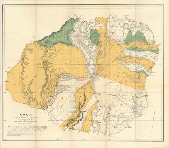
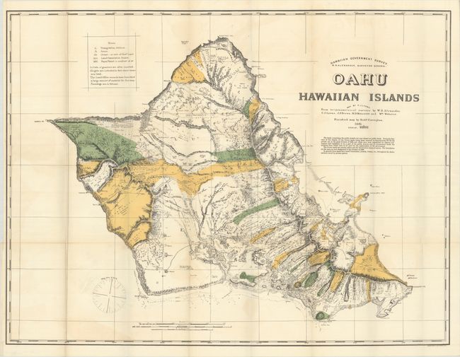
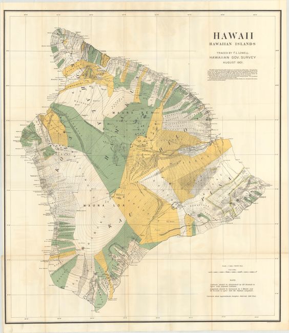
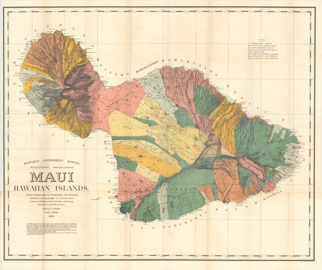
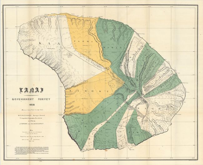
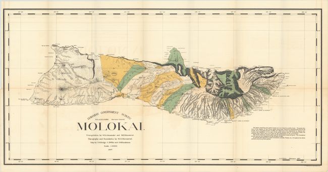
A nice set of maps issued shortly after the United States' annexation of Hawaii (based upon earlier maps that have been updated). The maps show the former Crown lands (yellow) awarded to King Kamehameha III in 1848 and government lands (green) which were merged and classified as Public Lands after annexation. Includes excellent detail of topography, volcanoes, watershed, coastal place names, and more. Printed by Julius Bien & Co. Lot includes the following maps:
A. Kauai Territory of Hawaii, dated 1901 (23.1 x 19.6").
B. Oahu Hawaiian Islands, dated 1881 (34.8 x 26.4").
C. Hawaii Hawaiian Islands, dated 1901 (32.1 x 36.3").
D. Maui Hawaiian Islands, dated 1885 (35.6 x 29.1").
E. Lanai Government Survey, dated 1900 (33.2 x 26.8").
F. Hawaiian Government Survey - Molokai, dated 1897 (34.1 x 16.8").
References:
Condition: A+
Fine examples, issued folding.