Subject: Kentucky, Ohio, Indiana
Period: 1838 (dated)
Publication:
Color: Hand Color
Size:
14.2 x 11.4 inches
36.1 x 29 cm
An attractive set of maps issued in Bradford's A General Atlas of the World. Larger and more detailed than Bradford's Comprehensive Atlas, each state map identifies counties, county seats, canals, wagon roads, early railroads, and more.
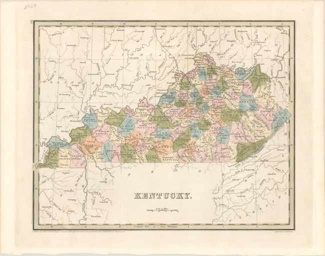
A. Kentucky (14.2 x 11.4"). Shows up-to-date county development as of 1836. It includes the newly formed Marion County in the central portion of the state as well as Clinton County along the southern border. Engraved by G.W. Boynton.
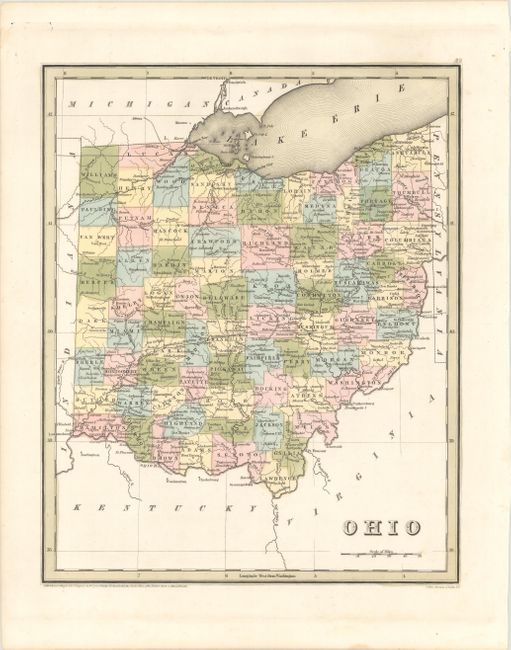
B. Ohio (11.3 x 14.0"). County development is current to approximately 1840, with the creation of Lake County in the northeastern part of the state. Engraved by Stiles, Sherman, and Smith.
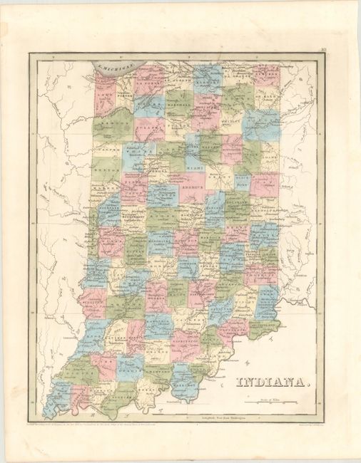
C. Indiana (11.4 x 14.1"). The map is current to 1838 with Newton still appearing in the northwestern portion of the state (it was abolished in 1839). Near the center of the state is the Miami Reserve. Engraved by G.W. Boynton.
References:
Condition: A
Nice impressions on clean, bright sheets. The map of Indiana has an edge tear confined to the bottom blank margin that has been closed on verso with archival tape.