Subject: Asia
Period: 1773-80 (circa)
Publication:
Color:
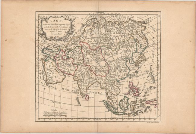
A. L'Asie, by Didier Robert de Vaugondy, from Nouvel Atlas Portatif, circa 1773, hand color (10.8 x 9.4"). This small map of the continent stretches from Turkey and the Middle East to the Bering Strait and New Guinea. Tibet is labeled Dalai Lama. Terre de Jeso appears to the north of Japan with an incomplete coastline. A vague Terre de la Comp? is also identified. The Great Wall of China is delineated. Engraved by E. Dussy. Reference: Pedley #377. Condition: On a lightly toned sheet with some light soiling and a centerfold separation in the bottom blank margin. (B+)
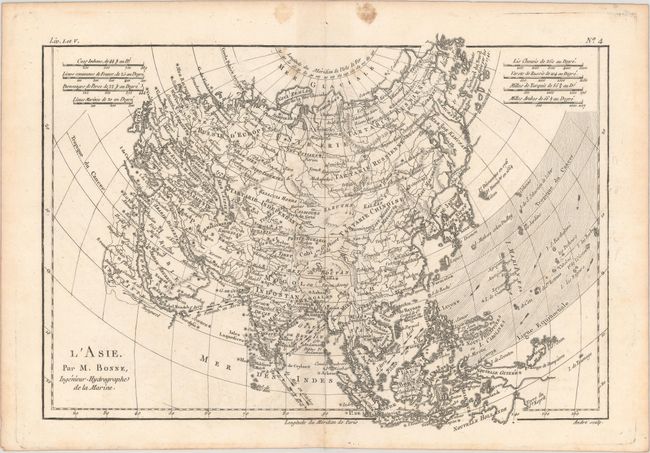
B. L'Asie, by Rigobert Bonne, from Atlas de Toutes les Parties Connues du Globe Terrestre, circa 1780, black & white (12.7 x 9.0"). Nice map of Asia with detail of the countries from Nova Zemla and the Bering Strait in the north to the East Indies and Australia in the south. The outline of Asia is typical of the period with a few revisions. East of Japan there is a group of small islands that were discovered in 1664 and 1716. Another group of islands off the east coast of Kamchatka is identified as the Archipel du Nord, noted as discovered by the Russians in 1740. Though their position is too far west these are probably part of the Aleutian Islands. The Nouvelle Philippines (the Carolines) also appear too far to the west. Monsoon winds in the Indian Ocean and South China Sea are marked by arrows. Eight distance scales appear in the top corners. Engraved by Andre. Reference: Yeo #181. Condition: There is light toning along the centerfold and two light stains in the top blank margin. (B+)
References:
Condition: B+
See description above.