Subject: Persia - Iran
Period: 1598-1612 (circa)
Publication:
Color: Hand Color
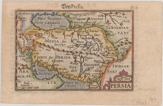
A. Persia, by Petrus Bertius, from Geographischer eyn oder Zusammengezogener Tabeln, circa 1612 (4.9 x 3.3"). This small map shows the region from the Caspian Sea to the Persian Gulf. The Caspian Sea is shown in a horizontal oval shape, and a rope-like mountain chain extends across Persia. The map is filled with place names and a simple cartouche. Engraved by Pieter van den Keere. German text on verso. Reference: Van der Krogt (Vol. III) #8200:341. Condition: A nice impression with very light toning. (B+)
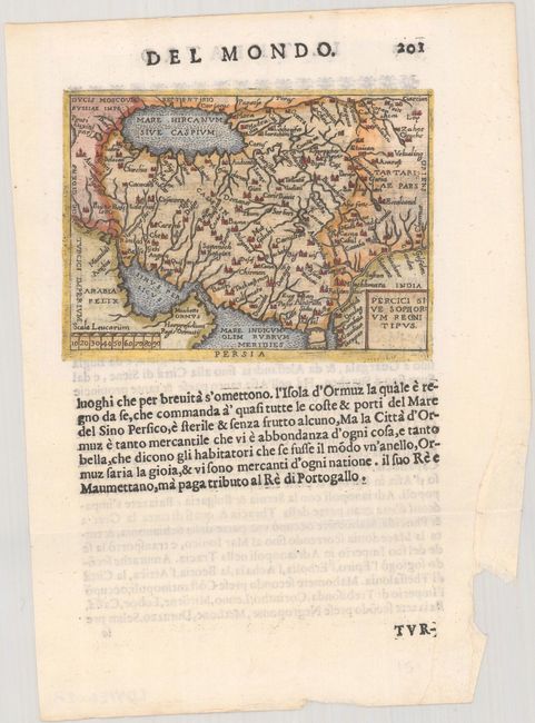
B. Percici sive Sophorum Regni Tipus, by Ortelius/Marchetti, from Il Theatro del Mondo, circa 1598 (4.0 x 2.8"). This handsome little map covers the Persian Empire between the Caspian Sea and the Persian Gulf and includes much of present-day Afghanistan and Pakistan. Italian text below the map and on verso. Pietro Maria Marchetti produced the second pocket atlas based on Abraham Ortelius' folio Theatrum. It is often referred to as the plagiarized version of the Epitome. The copper plates are closely copied from those of Philip Galle's 1593 Italian edition. Reference: King (2nd ed.) pp. 78-79. Condition: Clean and bright with a chip at bottom right, well away from the image. (A)
References:
Condition:
See description above.