Catalog Archive
Auction 178, Lot 451

"Carte de l'Arabie, Redigee en Grande Partie d'Apres le Voyage Recent et les Cartes de M. Niebuhr", Brion de la Tour, Louis
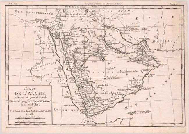
Subject: Arabia

Period: 1780 (circa)

Publication: Histoire Universelle

Color: Black & White

Size:
13.5 x 9.1 inches
34.3 x 23.1 cm
Download High Resolution Image
(or just click on image to launch the Zoom viewer)

This handsome map of the Arabian Peninsula is based on Carsten Niebuhr's travels with the Danish Arabia expedition (1761-67). The map extends to show Beirut, Damascus, the Holy Land, Cairo, the Nile, and southern Persia, but most of the detail is concentrated on the peninsula. There are plenty of place names and nice topographical detail. Two distance scales are enclosed in the simple block title cartouche at bottom left.

References:

Condition: B+

Issued folding, now flat, with minor soiling, a small abrasion at left, and a hint of offsetting. A chip in the top right corner has been repaired with archival materials, with a portion of the neatline and border replaced in facsimile.

Estimate: $160 - $190

Unsold

Closed on 6/10/2020

Archived