Subject: Middle East
Period: 1778-93 (circa)
Publication:
Color: Hand Color
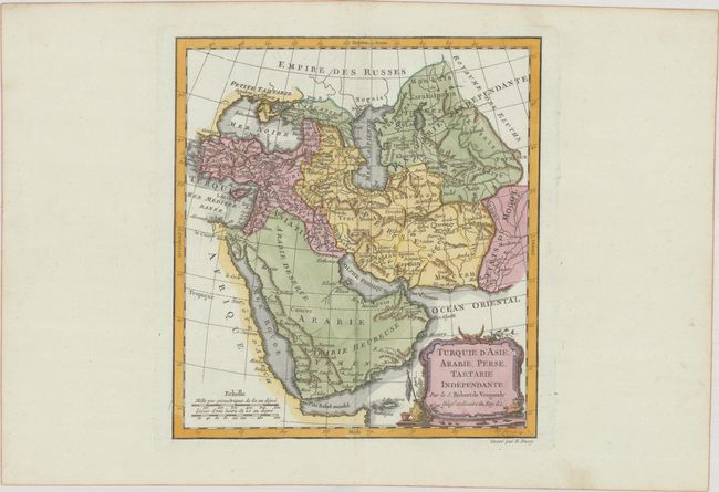
A. Turquie d'Asie, Arabie, Perse, Tartarie Independante, by Didier Robert de Vaugondy, from Nouvel Atlas Portatif, published 1778 (8.6 x 9.4"). Nicely engraved map with the Arabian Peninsula figuring prominently. The map shows all of Turkey and the Black Sea, and extends east to include the Caspian Sea and the region of today's Afghanistan, Pakistan, and Turkmenistan. The map was engraved by E. Dussy and the cartouche by Arrivet. References: Pedley #380.
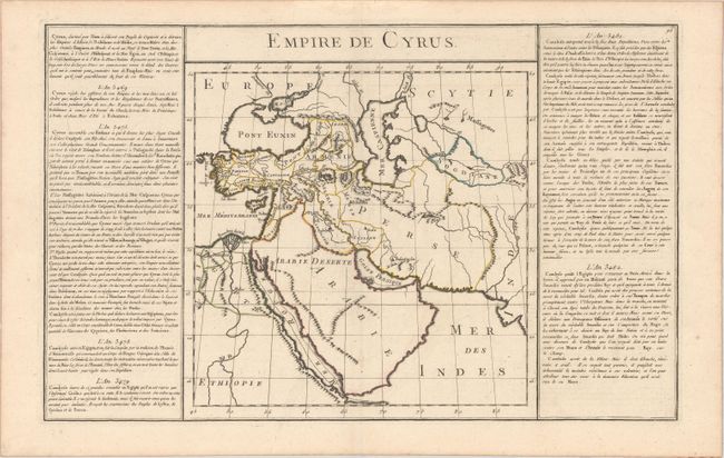
B. Empire de Cyrus, by Claude Buy de Mornas, from Atlas Methodique et Elementaire de Geographie et l'Histoire, circa 1793 (10.1 x 11.3"). This map depicts the region under the rule of Cyrus the Great, the founder of the Achaemenid Empire, the first Persian Empire. The map is flanked with panels of French text outlining the history of the region under Cyrus the Great's rule. With French text measures 17.9 x 11.3". References: Shirley (BL Atlases) #T.BUY-2a.
References:
Condition: A
Crisp impressions on bright sheets with minor marginal soiling.