Catalog Archive
Auction 178, Lot 425

"[Lot of 2] The Persian Empire Divided into Twenty Governments by Darius Son of Histaspes [and] Imperium Persicum Tempore Cyri Magni",

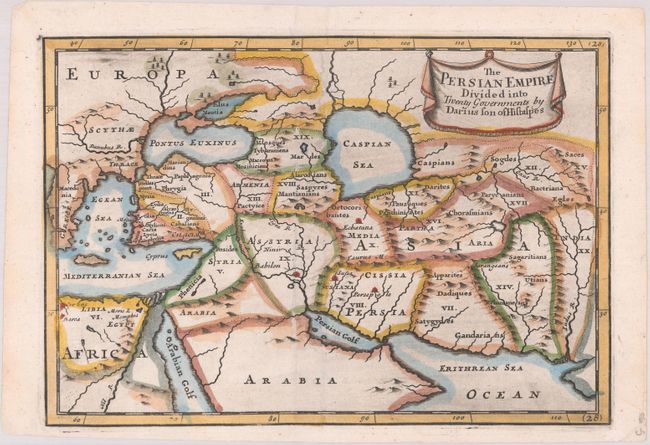
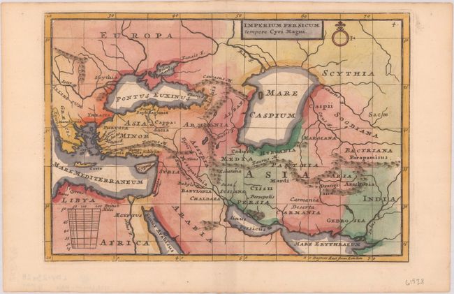
Subject: Eastern Mediterranean & Middle East

Period: 1720-25 (circa)

Publication:

Color: Hand Color

Size:
See Description
Download High Resolution Image
(or just click on image to launch the Zoom viewer)

Two small maps depicting the Persian Empire from the Balkans to present-day Pakistan. Both maps give basic information with rivers and a few place names identified, and show the Caspian Sea in a rudimentary shape.

A. The Persian Empire Divided into Twenty Governments by Darius Son of Histaspes, by Christopher Browne, from Geographia Classica: The Geography of the Ancients, circa 1720 (9.0 x 6.2"). References: cf. McCorkle (18th C. Geography Books) #117 [28].

B. Imperium Persicum Tempore Cyri Magni, by Herman Moll, from Geographia Antiqua, circa 1721 (8.8 x 6.1"). References: McCorkle (18th C. Geography Books) #284 [4].

References:

Condition: A

Nice impressions on bright sheets with later color.

Estimate: $140 - $170

Sold for: $100

Closed on 6/10/2020

Archived