Catalog Archive
Auction 178, Lot 362
"[On 2 Sheets] Marchionatus Moraviae Circulus Preroviensis quem Mandato Caesareo...", Homann, Johann Baptist
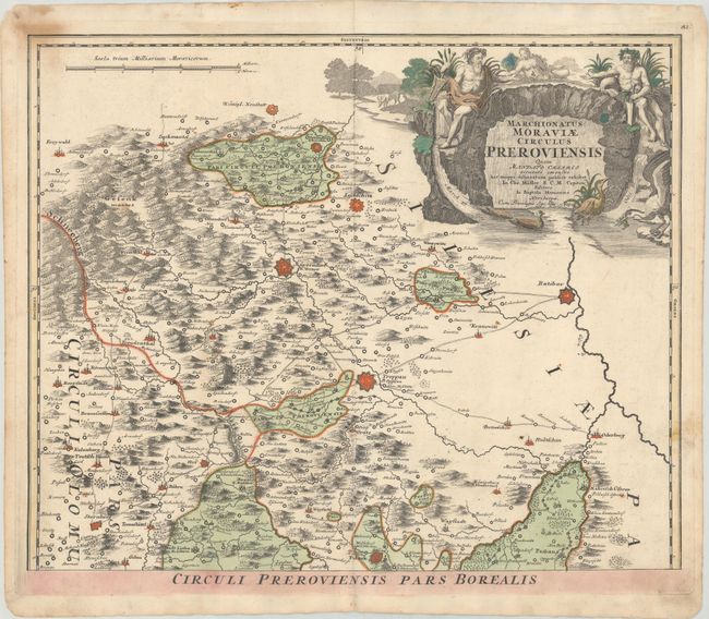
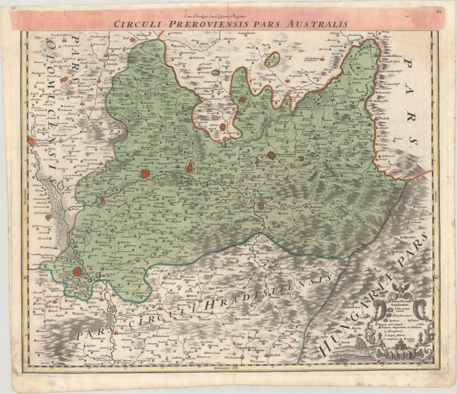
Subject: Eastern Czech Republic
Period: 1740 (circa)
Publication:
Color: Hand Color
Size:
22.5 x 18.3 inches
57.2 x 46.5 cm
Download High Resolution Image
(or just click on image to launch the Zoom viewer)
(or just click on image to launch the Zoom viewer)