Catalog Archive
Auction 178, Lot 339

"Plan of the City and Castle of Alicant, Besieged by the Chevalier d'Asfeldt Nov. 30th. 1708 and Surrendered by Capitulation Apr. 19th. 1709", Rapin-Thoyras, Paul de

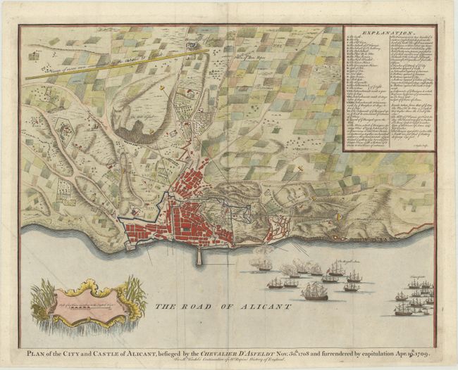
Subject: Alicante, Spain

Period: 1745 (circa)

Publication: Mr. Tindal's Continuation of Mr. Rapin's History of England

Color: Hand Color

Size:
18.5 x 14.3 inches
47 x 36.3 cm
Download High Resolution Image
(or just click on image to launch the Zoom viewer)

Detailed plan of this Spanish Mediterranean city, with fortifications, troop positions, ships in harbor, etc. This scene depicts the siege of Alicante by the French fleet during the War of the Spanish Succession. The map includes a lettered key identifying numerous locations. Finely engraved by Isaac Basire and published in Tindal's English edition of Mr. Rapin's The History of England.

References: Shirley (BL Atlases) G.RAP-1a #32.

Condition: B+

Issued folding, now pressed, with light soiling and some extraneous creasing.

Estimate: $160 - $190

Sold for: $100

Closed on 6/10/2020

Archived