Subject: United States, Mexico & Central America
Period: 1868 (circa)
Publication: Neuer Atlas der Ganzen Erde...
Color: Hand Color
Size:
15.9 x 25.9 inches
40.4 x 65.8 cm
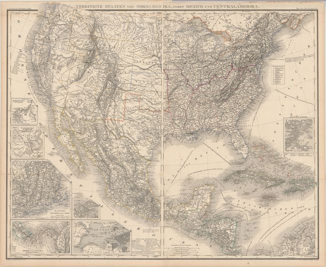
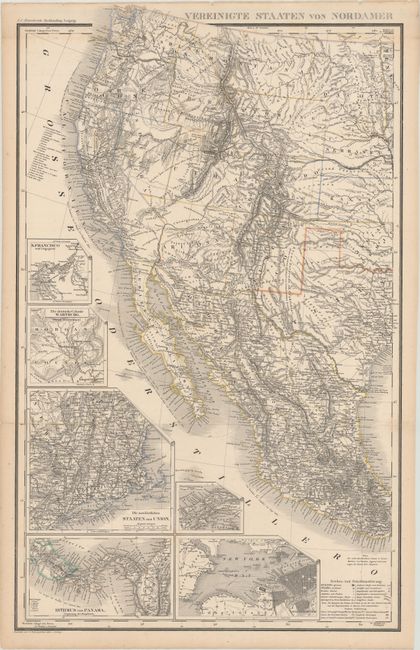
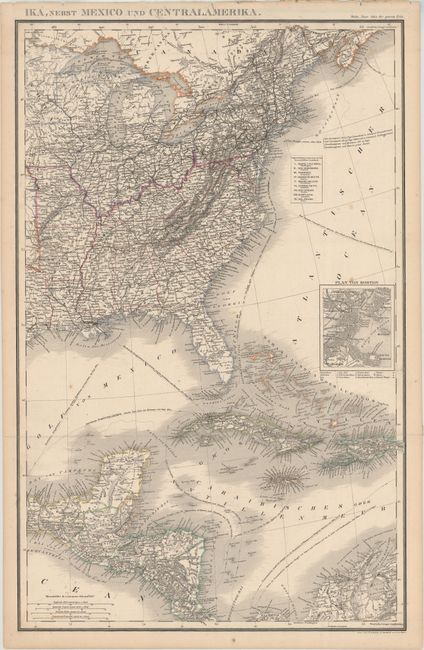
This fascinating two-sheet German map of the United States, Mexico, the Caribbean, and Central America would measure about 32.0 x 25.9" if joined. Although it was published after the Civil War, a key at the bottom of the western sheet identifies slave states and free states and territories. However, the colorist is not always accurate; for instance, an unnamed West Virginia is delineated as part of the Confederacy. There are many recently established territories in the West including Dacota (1861), Idaho (1863), Arizona (1863), Montana (1864), and Wyoming (1868). The inclusion of the latter and the appearance of Nebraska as a state dates the map to circa 1868. The map includes insets of New England, San Francisco, New York, Boston, the German colony of Wartburg in Tennessee, the Isthmus of Panama, and central Panama (showing the rail line between Chagres and Panama City). Ship routes and their distances are noted in the oceans. The map was created by G. Heck, R. Schmidt, H. Eberhardt, and J.L. v. Boehr. Published in Leipzig by Stein, Christian & Gottfried Daniel Stein.
References:
Condition: B+
Issued folding with contemporary outline color. There are a couple fold separations that have been repaired with archival tape on verso, light scattered foxing, and toning in the margins. The first image is a composite image - the map is in two separate sheets.