Catalog Archive
Auction 178, Lot 182

"A Scott-Map of the White Mountains of New Hampshire",

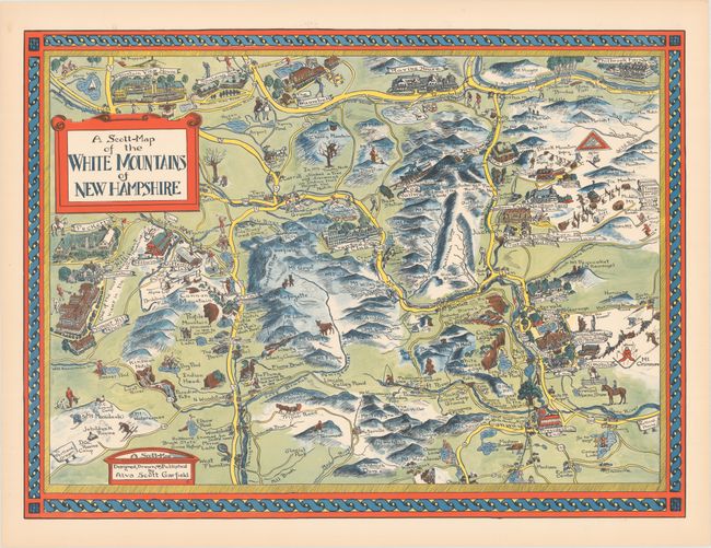
Subject: New Hampshire

Period: 1949 (circa)

Publication:

Color: Printed Color

Size:
27.6 x 20.4 inches
70.1 x 51.8 cm
Download High Resolution Image
(or just click on image to launch the Zoom viewer)

This highly illustrative map emphasizes the recreational and outdoor opportunities available in the region. Mt. Washington is located near the center, and several ski areas are identified. Hotels include the Mountain View House, Presidential Inn, and Sunset Hill House that has "one of the most magnificent views in the White Mountains."

This lovely pictorial map was created by Alva Scott Garfield. Scott's cartographic career began in 1926 with a decorative pictorial map of her alma mater, Wellesley College, and was entitled Newe Mapp of Wellesley. In 1929, Scott produced another campus map of nearby Wheaton College (MA). Scott took a 20-year hiatus from map production to focus on other endeavors, but in the late 1940s began producing both campus maps and regional views in New England. Roderick Barron of Barron Maps wrote an outstanding article describing Alva Scott Garfield's life & work here.

References: Hornsby (Picturing America) p. 22; Rumsey #8782.

Condition: A+

A clean and bright example.

Estimate: $200 - $230

Sold for: $600

Closed on 6/10/2020

Archived