Subject: Jacksonville, Florida
Period: 1940 (circa)
Publication:
Color: Printed Color
Size:
12.9 x 8.2 inches
32.8 x 20.8 cm
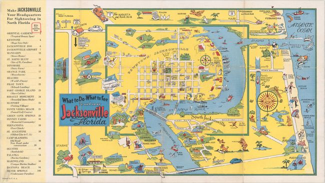
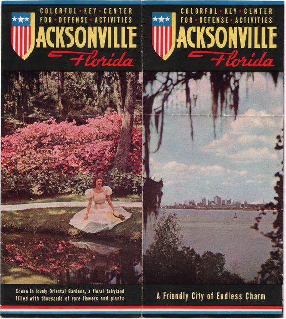
This colorful pictorial map of Jacksonville extends to the Atlantic beaches from Fernandina south to St. Augustine. It is filled illustrations highlighting the numerous tourist attractions in the region, and a table at left lists mileage to points of interest from Hemming Park, the location of the Tourist and Convention Bureau and publisher of the map. The verso is filled with related text and illustrations describing the "parade of pleasures awaiting you in Jacksonville." The map is circa 1940 based upon the appearance of Camp Blanding in the lower left corner of the map image. Self-folding pictorial wrappers (4.0 x 9.0").
References:
Condition: B+
Issued folding on a clean sheet with minor wear along the fold lines and an extraneous horizontal crease.