Subject: California, Gold
Period: 1835-48 (circa)
Publication:
Color: Black & White
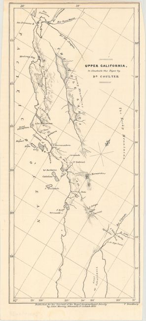
A. Upper California, to Illustrate the Paper by Dr. Coulter, by John Murray, from Journal of the Royal Geographical Society, dated 1835 (4.4 x 10.0"). This scarce small map of coastal California extends from San Francisco to the Gulf of California. Locates the Snowy Mountains, Santa Barbara, and San Diego. A "Pueblo" is located on the site of the future site of Los Angeles. Published for the Journal of the Royal Geographical Society by John Murray. Engraved by C. Bradbury. Condition: Near fine. (A)
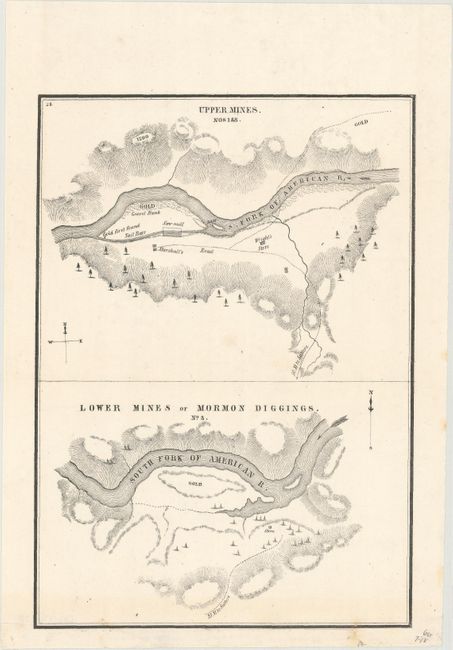
B. Upper Mines. Nos. 1 & 8 [on sheet with] Lower Mines or Mormon Diggings. No. 3, by U.S. Government, circa 1848 (6.4 x 9.0"). These small maps were issued in Colonel Mason's famous report that spawned the great California Gold Rush. The top half shows the Upper Mines along the South Fork of the American River and notes where gold first found by James W. Marshall. The bottom map depicts numerous tents surrounding a store with a large area of the river bar marked gold. Reference: Wheat (Gold) #52. Condition: Near fine with a minor archival repair to a cut along the bottom border. (A)
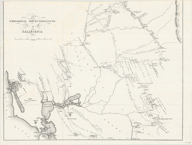
C. Geological Reconnoissances in California, by U.S. Government, circa 1848 (14.8 x 11.6"). This California Gold Rush map shows the area from San Francisco Bay north and east to the Yuba River and east to the Calaveras River. Published in Tyson's Report upon the Geology and Topography of California, the map traces his route from San Francisco by way of Vernon to the Yuba diggings, then south passed the Emigrant's Road to the Salt Lake, through the gold region to the Calaveras River, and west through Bonsal's Ferry, Livernore’s Ranch and Martinez. It notes dates of his encampments, geological types, and the points where gold was being mined. According to Wheat, Tyson's work was "probably the earliest work of a true scientific research to emerge from the Gold Rush." Reference: Wheat (Gold) #179. Condition: The top border has been trimmed away by the binder as is commonly seen on this map. (B)
References:
Condition:
Issued folding on clean sheets. See description above for details.