Subject: Nova Scotia & Cape Breton Island, Canada
Period: 1744-56 (circa)
Publication:
Color: Black & White
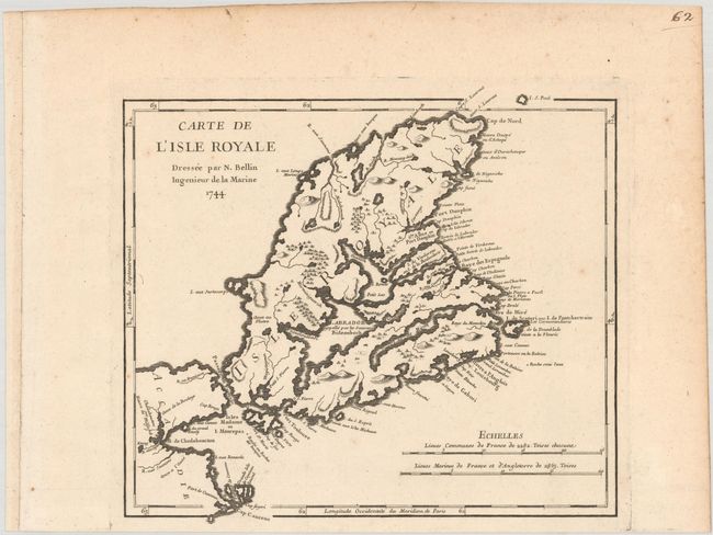
A. Carte de l'Isle Royale, dated 1744 (10.4 x 9.4"). A strongly engraved map of Cape Breton Island and eastern Canada that includes topography and coastal place names. War broke out between France and England in 1744, and a large number of maps were produced to describe the areas involved. References: Kershaw #862. Condition: A sharp impression on a watermarked sheet with marginal toning and soiling. (A)
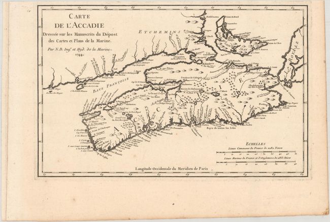
B. Carte de l'Accadie Dressee sur les Manuscrits du Depost des Cartes et Plans de la Marine, dated 1744 (12.6 x 8.0"). A nice map of Nova Scotia and Prince Edward Island (Isle Saint Jean). References: Kershaw #768. Condition: A sharp impression on a watermarked sheet with light toning along the edges of the sheet and a few spots of foxing mostly confined to the blank margins. (A)
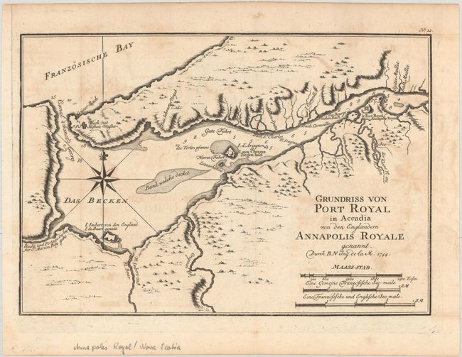
C. Grundriss von Port Royal in Accadia von den Englaendern Annapolis Royale Gennant, dated 1744 (11.1 x 7.6"). This map details the region around Port Royal including the walled Fort Royal, topography and watershed, islands and shoals in the vicinity. References: Kershaw #770. Condition: A crisp impression on watermarked paper with light offsetting. (B+)
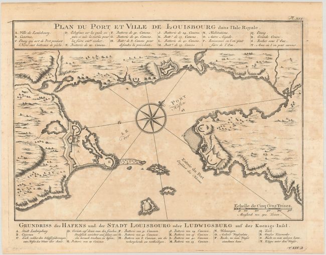
D. Plan du Port et Ville de Louisbourg dans l'Isle Royale, circa 1756 (11.0 x 7.6"). This plan depicts Louisbourg, the French fortified settlement on Cape Breton Island. War broke out between France and England in 1744, and a large number of maps were produced to describe the areas involved. The French lost Louisbourg to a determined British army, but the treaty of Aix-la-Chappelle returned Louisbourg to the French in 1748. By 1758 Louisbourg was once again besieged by the British, and in 1760 the fortress was leveled. Published only a few years prior to its destruction, the plan shows the harbor of Louisbourg in the southeast portion of the island in great detail. A large compass rose topped with a fleur-de-lis in the harbor orients the map with the north to the upper right corner. The German title appears below: Grundriss des Hafens und der Stadt Louisbourg oder Ludwigsburg auf der Koenigs-Insel. References: Kershaw #887. Condition: A nice impression with offsetting and toning. (B)
References:
Condition:
See description above.