Subject: South Africa, Geology
Period: 1925 (dated)
Publication:
Color: Printed Color
Size:
38.4 x 28.8 inches
97.5 x 73.2 cm
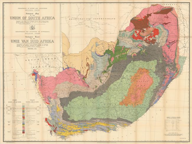
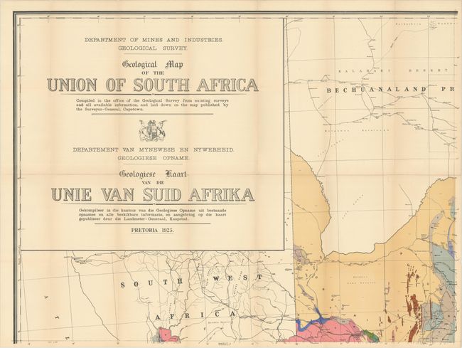
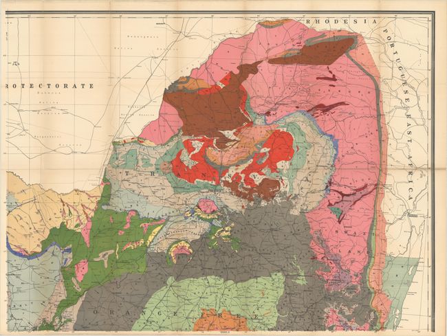
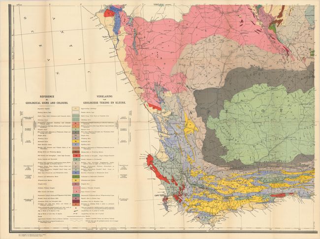
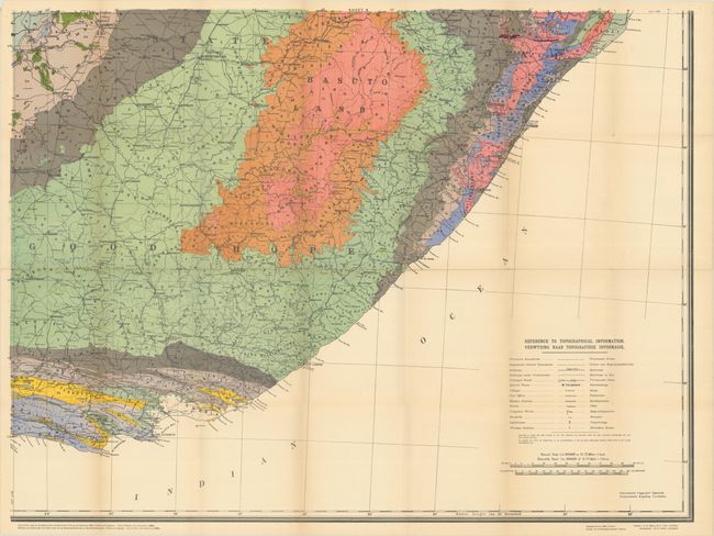
This mammoth map was issued on four sheets and measures approximately 78" x 58" if joined. It is color-coded to reveal 29 different geological types including red granite, volcanic and sedimentary rocks, superficial deposits, and marine beds to name a few. The map is augmented by topographical information including railroads, roads, post offices, mission stations, irrigation works, and lighthouses for a comprehensive view of the country. Includes title and legend in both English and Afrikaans (the map is in English). Drawn by Eric Banks and published by the Department of Mines and Industries in Pretoria. The map was originally accompanied by a 34-page report (not present) entitled The Geological Structure of the Union : An Explanation of the Geological Map of the Union of South Africa by A.W. Rogers.
References:
Condition: B+
Issued folding on thick sheets with bold color. There is light toning along the fold lines and a number of small separations mostly at the fold junctions. The first image is a composite image - the map is in four separate sheets.