Subject: Africa
Period: 1659 (circa)
Publication: Introductionis in Universam Geographicam
Color: Hand Color
Size:
4.9 x 4.8 inches
12.4 x 12.2 cm
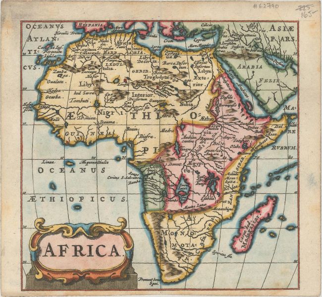
This striking miniature map is Cluver's second map of the continent. Its cartography draws on the Cluver-Buno map of 1641. The source of the Nile is located south of the equator in the twin lakes of Zaire and Zafla. To the south of these Ptolemaic lakes are the Montes Lunae (Mountains of the Moon). Aethiopia appears across the continent in large letters, and the name Monomotapa appears in the southern tip. A decorative title cartouche fills the bottom left corner. The map appeared in multiple editions of Introductionis in Universam Geographicam published by the Elzevier house in Amsterdam starting in 1659.
References: Betz #93.
Condition: A
A crisp impression with a couple minor spots at bottom right and marginal soiling.