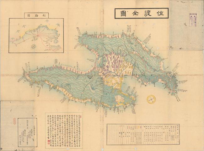
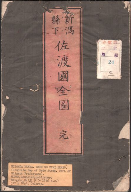
Subject: Sado Island, Japan
Period: 1876 (circa)
Publication:
Color: Hand Color
Size:
34.5 x 26.8 inches
87.6 x 68.1 cm
This Japanese woodblock map shows Sado Island, part of Niigata Prefecture. A compass orients north to the bottom left of the sheet. The city of Sado encompasses the center of the island while the remaining portion of the island is composed of two parallel mountain ranges, which are graphically illustrated. An inset map at top left shows the island in relation to Honshu, illustrating the boat routes to the island. Published by Zenheizo Homma. Printed on 4 sheets, joined as issued and folding in heavy paper wrappers with printed title label.
References:
Condition: B
Minor soiling with a number of fold separations and small worm tracks scattered throughout.