Subject: Central Germany
Period: 1593 (published)
Publication: Speculum Orbis Terrae
Color: Black & White
Size:
19.8 x 11.8 inches
50.3 x 30 cm
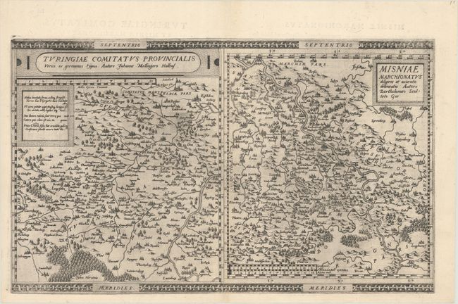
This sheet includes two handsome maps enclosed within its decorative borders. The map of Thuringia centers on Erfurdt (Erfurt), between the Saale and Werra Rivers. It is based on the cartography of Johann Mellinger. The map of Misnia is based on the cartography of Bartolomew Sculteto. The Elbe River cuts across the map, which extends into a portion of the Czech Republic. It names Wittenberg, Halle, Leipzig, Meissen, Dresden, and Freiberg. The map was issued in Cornelis de Jode's Speculum Orbis Terrae in 1593, which was a revised edition of an earlier atlas published by his father Gerard in 1578. While the atlas did not have much commercial success, de Jode's maps are often regarded as superior in both design and cartographic detail to his more successful competitor, Abraham Ortelius.
References: Shirley (BL Atlases) T.JOD-1c; Van der Krogt (Vol. III) #2120 + 2110:32.
Condition: A+
A fine example on a sheet with a crossed arrows watermark.