Catalog Archive
Auction 177, Lot 458

"[Lot of 2] Partie Septentrionale du Royme de Hongrie Tiree de Divers Autheurs [and] Partie Meridionale de Rme. de Hongrie Tiree de Divers Autheurs", Sanson/Mariette
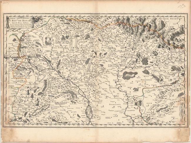
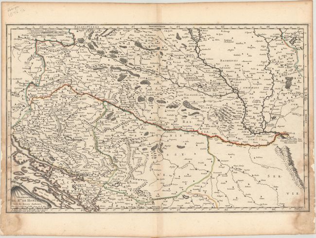
Subject: Central Europe

Period: 1664 (dated)

Publication: Cartes Generales de Toutes les Parties du Monde…

Color: Hand Color

Size:
22.8 x 14.2 inches
57.9 x 36.1 cm
Download High Resolution Image
(or just click on image to launch the Zoom viewer)

These two maps together present the Hungarian Empire in the middle of the 17th century. The boundaries extend from present-day Slovakia in the north to present-day Serbia, Croatia and Bosnia in the south. On the northern sheet, Budapest is shown as the separate cities of Buda, Offen and Pesth, which were merged into the city of Budapest occupying both banks of the river Danube in 1873. On the southern sheet, Belgrade is pictured atop a hill at the confluence of the Sava and Danube rivers. The maps are filled with hundreds of towns identified by small buildings, forests, rivers, and pictorial topography. Each sheet is complete with its own title cartouche and borders.

References: Pastoureau, SANSON V B [150] & [151].

Condition: B

Contemporary outline color with dampstains at lower left and right that have been reinforced on verso with old paper.

Estimate: $350 - $425

Unsold

Closed on 4/29/2020

Archived