Subject: Mahon, Cadiz, & Lleida, Spain
Period: 1745 (circa)
Publication: Mr. Tindal's Continuation of Mr. Rapin's History of England
Color: Black & White
Size:
14.9 x 17.8 inches
37.8 x 45.2 cm
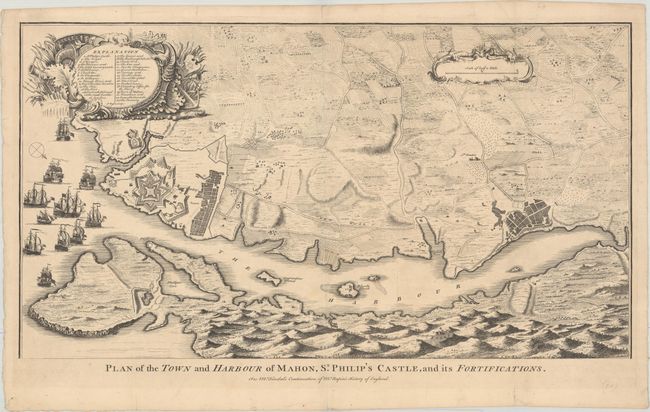
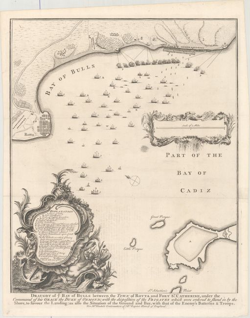
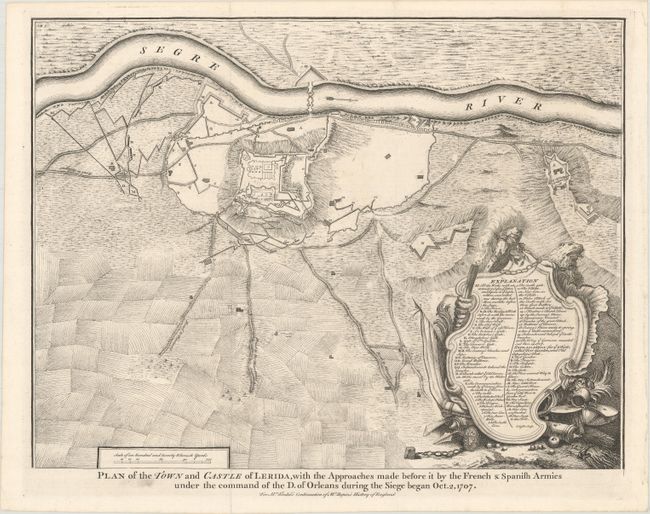
This lot includes 3 plans from Tindal's Continuation of Mr. Rapin's History. Nicolas Tindal translated Paul de Rapin's History of England into English shortly after the French edition's release (1724-1727), and would later add volumes covering the reign of James VI and I (1566-1625) to George I (1660-1727) which represent the "continuation." These plans depict the fortifications of Spanish towns that were the sites of conflict during the War of the Spanish Succession. Each includes an ornate cartouche containing a key to important locations. Engraved by J. Basire.
A. Plan of the Town and Harbour of Mahon, St. Philip's Castle, and Its Fortifications (24.7 x 13.6"). This handsome plan focuses on the fortifications in Mahon, Menorca, including St. Philip's Castle. The British captured Mahon in 1708. There is excellent detail of the harbor and surrounding countryside. Several ships fill the waters. Condition: A nice impression issued folding with minor soiling and some short fold separations in the blank margins that have been closed on verso with archival tape.
B. Draught of ye Bay of Bulls Between the Town of Rotta and Fort St. Catherine, Under the Command of His Grace the Duke of Ormond..., circa 1745 (14.9 x 17.8"). An interesting map illustrating an aborted attempt by the British to capture Cadiz during the War of Spanish Succession. The scale is displayed within a second decorative cartouche. The title appears beneath the map. Condition: A sharp impression issued folding on watermarked paper with a 1.5" fold separation and associated tear at right that have been closed with tape. There is minor offsetting from an opposing page of text.
C. Plan of the Town and Castle of Lerida, with the Approaches Made Before It by the French & Spanish Armies Under the Command of the D. of Orleans During the Siege Began Oct. 2, 1707 (18.5 x 14.1"). This fine plan illustrates the extensive fortifications of Lleida situated on the banks of the river Segre in northwestern Catalan. It depicts the siege of the city in October 1707. Condition: A crisp impression issued folding on watermarked paper with some short fold separations, a couple of which just touch the neatline.
References: Shirley (BL Atlases) G.RAP-1a #1, #18, and #28.
Condition: A
See description above.