Subject: Northwestern France
Period: 1689 (dated)
Publication:
Color: Hand Color
Size:
17.7 x 23.8 inches
45 x 60.5 cm
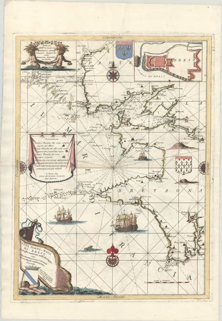
This elegantly engraved chart covers the coast of Brittany from Portsall south to the mouth of the Odet River. It names several towns and villages, including Brest, Crodon (Crozon), Plougon (Plogoff), Audierne, and Quimpercoretin (Quimper). The chart is crisscrossed with rhumb lines, and islands, rocks, and hazards are located in the sea. An inset plan of Brest's fortifications appears at top right. The chart is further decorated with ornate compass roses, two sailing ships, three coats of arms, and three decorative cartouches. It first appeared in Coronelli's Atlante Veneto in 1691 before appearing in other subsequent collections and publications.
References: cf. Shirley (BL Atlases) T.CORO-7a #37.
Condition: B+
A fine impression on watermarked paper with some printer's ink residue and a small tear near the center of the map that has been repaired on verso with archival materials.