Catalog Archive
Auction 177, Lot 418

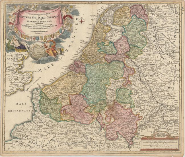
"Tabula Generalis Totius Belgii qua Provinciae XVII. Infer. Germaniae olim sub S.R.I. Circulo Burgundiae...", Homann, Johann Baptist
Subject: Low Countries

Period: 1716 (published)

Publication:

Color: Hand Color

Size:
22.6 x 19.1 inches
57.4 x 48.5 cm
Download High Resolution Image
(or just click on image to launch the Zoom viewer)

A detailed and decorative map of the Netherlands, Belgium and Luxembourg with parts of France and the United Kingdom (including London). An elaborate cartouche shows the heraldic shields of the 17 provinces as well as Neptune and Hermes with a globe indicating the Dutch East Indies.

References:

Condition: B+

A nice impression on paper with an "SS" watermark, contemporary color in the map and later color in the cartouche. There is a stain east of Namur, a printer's crease adjacent to the centerfold at top and light toning along the edges of the sheet. The top edge was trimmed to the neatline by the bookbinder.

Estimate: $200 - $230

Sold for: $150

Closed on 4/29/2020

Archived