Catalog Archive
Auction 177, Lot 370

"A Large Chart of the Downs, Shewing the Sands, Shoals, Depths of Water & Anchorage, with All the Leading Marks to Avoid Dangers", Mount & Page

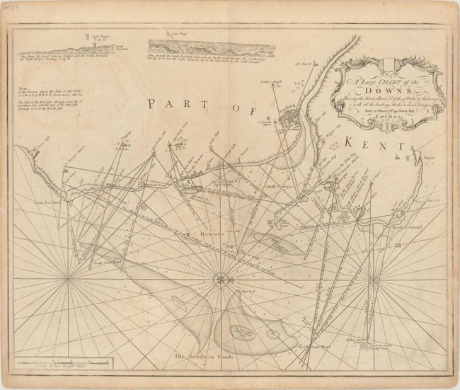
Subject: Southeastern England

Period: 1780 (circa)

Publication:

Color: Black & White

Size:
23.5 x 18.6 inches
59.7 x 47.2 cm
Download High Resolution Image
(or just click on image to launch the Zoom viewer)

This handsome chart depicts the coastline of Kent between Dover Castle and Margate. Towns are identified by clusters of tiny buildings and include Sandwich, Deal, and Ramsgate to name a few. Numerous soundings, shoals, anchorages, and notations are illustrated along the coast. Includes two profiles of South Foreland at top. Decorated by a strapwork title cartouche and compass rose with fleur-de-lis, which orients north to the right.

References:

Condition: B+

There is light offsetting with a short centerfold separation that just passes the neatline at bottom.

Estimate: $275 - $350

Sold for: $180

Closed on 4/29/2020

Archived