Subject: Europe
Period: 1716 (published)
Publication:
Color: Hand Color
Size:
22.4 x 18.9 inches
56.9 x 48 cm
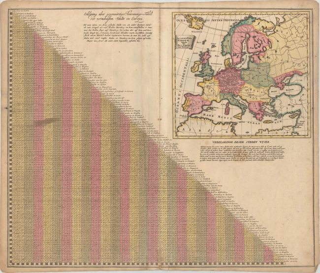
Half of this sheet is filled with a guide to distances between all the "most distinguished" cities in Europe (with of course the majority of the cities falling in Germany). Beside the table of distances are German and Dutch explanations on how to use the table. A map of Europe by Peiter Schenk (Accuratissima Europae Tabula) fills the remaining space, identifying only the cities listed in the distance guide. Germany is entirely filled with minute place names that can barely even be read when zooming in fully on the image - what a challenge for the engraver!
References:
Condition: B
A nice impression with full contemporary color, moderate soiling, extraneous creasing along the centerfold, and a 2" centerfold separation at bottom. There is a small piece of masking tape along the bottom edge of the sheet on verso.