Subject: Strait of Magellan
Period: 1717 (published)
Publication: Relation du Voyage de la Mer du Sud aux Cotes du Chili et du Perou
Color: Hand Color
Size:
11.4 x 7.4 inches
29 x 18.8 cm
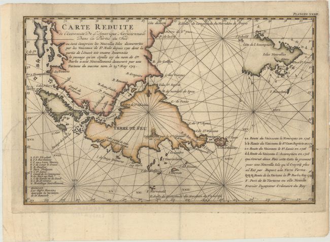
This rare, small French map shows the recent discoveries at the southern tip of South America. The routes of several expeditions around the Falkland Islands and through the Strait of Magellan are traced and listed at bottom right, including those of the ships Maurepas in 1706, St. Jean Baptiste in 1711, St. Louis in 1706, Assumption in 1708, and St. Barbe in 1713. Additional locations are identified by a capital-lettered key at bottom left. There is a flaming volcano depicted in Tierra del Fuego, "as seen by Sr. Clement in 1712."
Frezier was a French military engineer, mathematician, intelligence officer, and explorer who spent much of his career planning fortifications for the French colonies around the world. A lieutenant-colonel of the French Army Intelligence Corps, Frezier was dispatched to South America to correct existing charts and study the defense fortifications of Chile, Peru and Brazil. Frezier is best known for bringing several specimens of strawberries back from South America and introducing them to Europe.
References: Shirley (BL Atlases) G.FREZ-2a #20.
Condition: A
A dark impression, issued folding and now flattened with light printer's ink residue. A tiny hole at a fold intersection and a short tear in the left blank margin have been archivally repaired.