Catalog Archive
Auction 177, Lot 301

"Plan of the City and Harbour of Havanna [on sheet with] Plan of the Bay of Matanzas, on the North Side of Cuba", Sayer, Robert

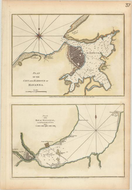
Subject: Havana & Matanzas, Cuba

Period: 1788 (dated)

Publication: West-India Atlas

Color: Hand Color

Size:
12.4 x 17.9 inches
31.5 x 45.5 cm
Download High Resolution Image
(or just click on image to launch the Zoom viewer)

This sheet includes two well-engraved maps, each printed from a separate plate. At top is Havana harbor with the fortified town and surrounding area, including Morro Castle, the batteries, storehouse, powder magazines, and hospital. At bottom is Matanzas Bay, identifying the town, fort, plantations, "best anchoring ground" and "best watering place." There are numerous soundings and anchorages located in each map, as well as a compass rose. Although Sayer largely copied these two maps from Jefferys, Sayer greatly improved the shape of Havana Bay.

References:

Condition: A

Printed on a sturdy sheet with an "IV" watermark, a couple of minor spots, and light toning along the edges of the sheet.

Estimate: $450 - $550

Unsold

Closed on 4/29/2020

Archived