Subject: Portland, Oregon
Period: 1925 (circa)
Publication:
Color: Printed Color
Size:
20.2 x 20.2 inches
51.3 x 51.3 cm
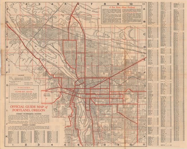
An early and detailed map of Portland, Oregon. Shows the street grid pattern along with railroads, street car lines (heavy black line) and routes in and out of the city (heavy red line). Locates parks, country clubs, Columbia University (University of Portland), and more. A note beneath the legend encourages readers to climb Mt. Hood where "the climb is not difficult but is an experience that will never be forgotten." Includes an extensive street index at right and informative text on verso including "suggestions for a ten day visit in Portland." There is no attribution, but the map was likely published by the Portland Chamber of Commerce. No past sales records and only four institutional copies located on OCLC.
References:
Condition: B+
Issued folding with light toning and several tiny splits at the fold junctions. A 1.5" fold separation at left has been closed on verso with archival tape.