Subject: Nantucket, Massachusetts
Period: 1897 (published)
Publication:
Color: Black & White
Size:
13.7 x 8.6 inches
34.8 x 21.8 cm
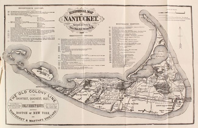
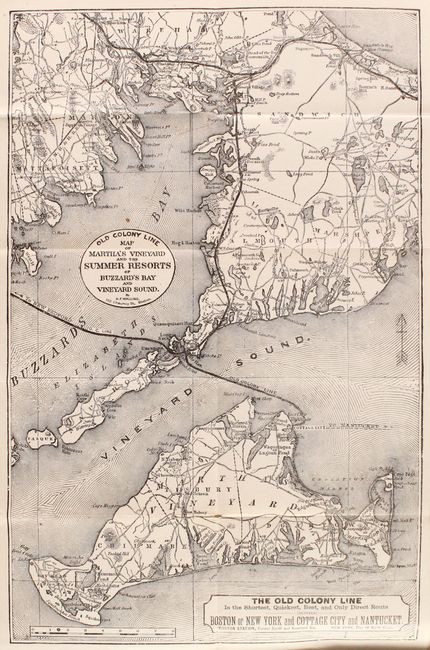
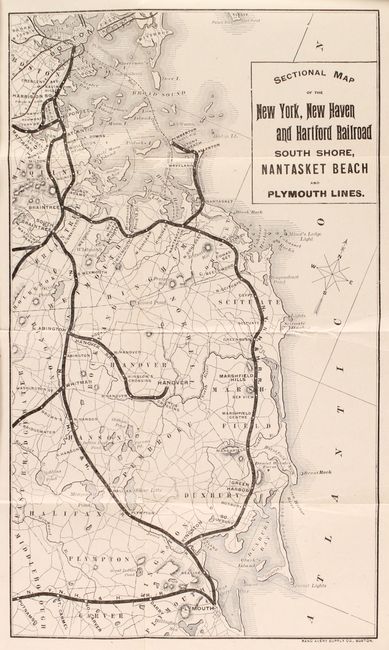
This ephemeral pocket map extends to show Muskeget and the Huckernuck islands. It advertises "The Old Colony Line is the Shortest, Quickest, Best, and Only Direct Route between Boston or New York, and Nantucket & Martha's Vineyard." The map is a reproduction of the one surveyed and drawn by the Rev. F.C. Ewer in 1869 and shows roads, villages and the boundaries of the Ancient Sachem Rights. It also includes a chronology of historical events from 1602 to 1885. The other folding maps include Old Colony Line Map of Martha's Vineyard and Summer Resorts of Buzzard's Bay and Vineyard Sound (9.0 x 14.0") and Sectional Map of the New York, New Haven and Hartford Railroad South Shore, Nantasket Beach and Plymouth Harbor (7.1 x 12.0").
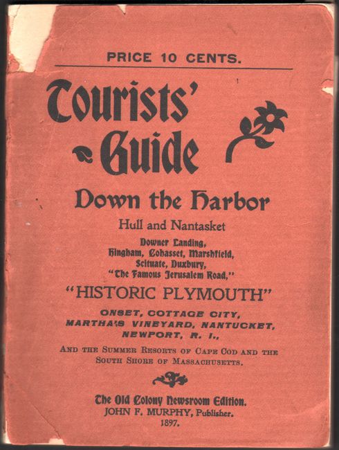
The maps are still bound in the original Tourists' Guide to Down the Harbor, Hull and Nantasket, Hingham...Martha’s Vineyard, Nantucket, Newport, R. I., and the Summer Resorts of Cape Cod and the South Shore of Massachusetts. 121 pages with numerous advertisements and in-text illustrations. 24mo., tan paper wrappers.
References:
Condition: A
The folding maps are clean, bright, and near fine. The text has a hint of pleasant light toning, and the paper wrappers have a few chips.