Subject: Boston, Massachusetts
Period: 1944-50 (circa)
Publication:
Color: Printed Color
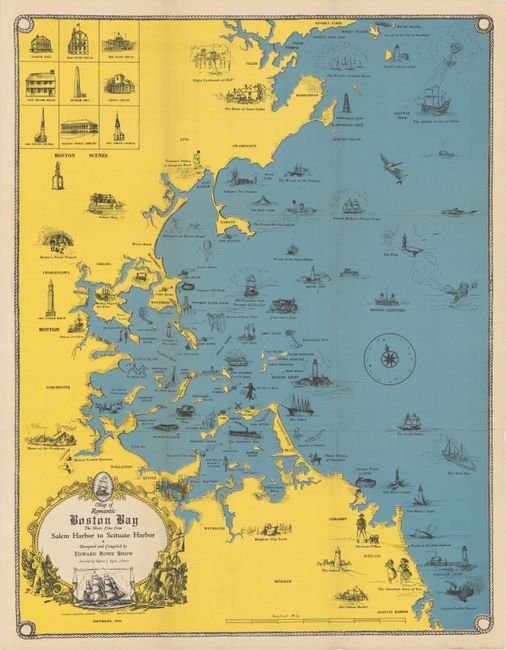
A. Map of Romantic Boston Bay -The Shore Line from Salem Harbor to Scituate Harbor, by Edward Rowe Snow, dated 1944 (16.3 x 21.3"). A nice pictorial map of the greater Boston area with numerous vignettes filling Boston Bay and the surrounding coastline. Illustrations include "Boston's Pirate Tunnel", "Eight Firebrands of Hell", "Old Ironsides Sails Through Shirley Gut", and many more. Further embellished by a decorative title cartouche, compass rose, windhead, and rope border.
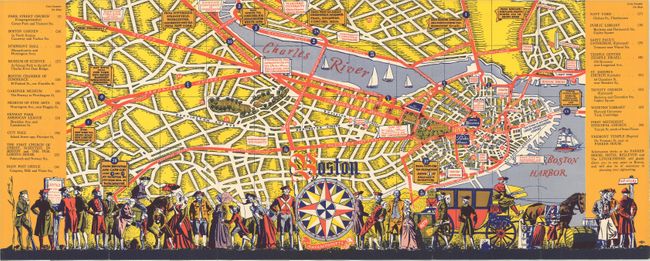
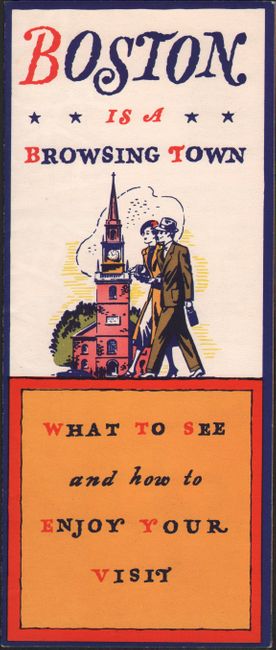
B. Boston Massachusetts, circa 1950 (22.4 x 8.9"). This brochure informs the tourist on "what to see and how to enjoy your visit." The colorful pictorial map on verso shows the street grid pattern of the city with numerous points of interest coded and/or labeled including Bunker Hill, Fort Hill Square, Boston Common, and several colleges and universities to name a few. Features a busy colonial scene at bottom. Published by Sherrard Hotels.
References:
Condition: A
Clean and colorful examples, issued folding.