Subject: Lanai, Hawaii
Period: 1900 (dated)
Publication:
Color: Printed Color
Size:
33.3 x 26.8 inches
84.6 x 68.1 cm
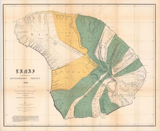
This fascinating and detailed early survey of the island was made under the direction of W.D. Alexander, Surveyor General of Hawaii Territory. The triangulation, topography, and boundaries are by J.F. Brown and M.D. Monsarrat. The island is divided into at least ten regions, all named and shown via coloration, with acreages given. It locates harbors, rocks, anchorages, school houses, villages, and peaks with elevations. Traced from the 1878 government survey map by Walter E. Wall and Fred E. Harvey.
References:
Condition: B+
Issued folding with several fold separations, including a 3" split at bottom left, most of which have been closed on verso with archival tape. There are minor spots and faint toning along the folds.