Subject: Miami, Florida
Period: 1941 (circa)
Publication:
Color: Black & White
Size:
26.4 x 15.1 inches
67.1 x 38.4 cm
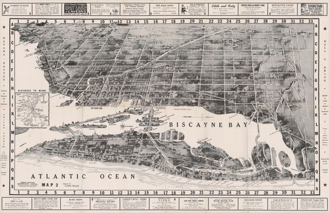
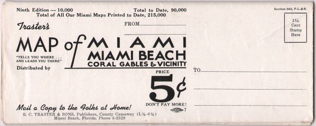
This World War II era bird's-eye view of Miami is oriented with west at the top of the map. Miami Beach and downtown are in the foreground, with Coral Gables and the airport in the background. Of particular interest is a number of small sections of the map that have been etched or shaded out, indicating redacted areas of wartime interest. Surrounding the map are numerous local advertisements. The verso contains an extensive index of hotels, restaurants, local attractions, and a small road map. Circa date is based upon advertisement at bottom for rental cars ("Cars rented – all 1941 models"). Self-folding (3.5 x 9.0").
References:
Condition: B+
Issued folding on a bright sheet. There are a few minor separations mostly at the fold junctions and a minor stain at left.