Subject: Colorado
Period: 1918 (dated)
Publication:
Color: Black & White
Size:
29 x 20.8 inches
73.7 x 52.8 cm
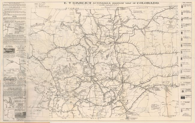
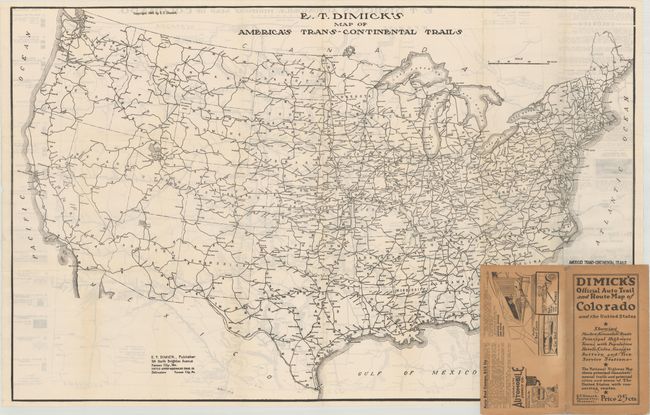
This scarce pocket map by E.T. Dimick of Kansas City shows the evolving road network in the state with a series of nineteen highway markers displayed in the right legend. In addition to these marked roads, the map shows local roads, railroads, and some basic topography. Numerous advertisements fill the left margin. The verso contains a second map entitled E.T. Dimick’s Map of America’s Trans-Continental Trails (33.0 x 21.0") that identifies 32 different driving trails. Folds into tan paper wrappers (4.4 x 7.8") with an interesting advertisement on the rear wrapper for "auto bed camps." There are no past sales records and only one institutional example located on OCLC.
References:
Condition: A
A bright example with two small splits at the fold junctions and light show-through from map on verso. Paper wrappers have light wear.