Catalog Archive
Auction 177, Lot 174

"General Chart Embracing Surveys of the Farallones Entrance to the Bay of San Francisco Bays of San Franciso and San Pablo…", Ringgold, Cadwalader

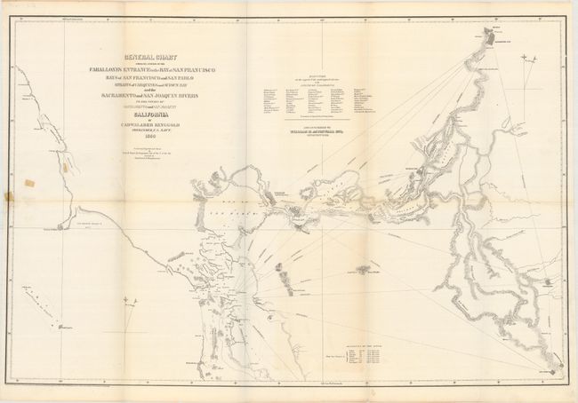
Subject: Northern California, Gold

Period: 1850 (dated)

Publication:

Color: Black & White

Size:
30.3 x 20.1 inches
77 x 51.1 cm
Download High Resolution Image
(or just click on image to launch the Zoom viewer)

An early and detailed chart covering the region from the San Francisco Bay inland to the Sacramento and San Joaquin rivers. Naval Commander Ringgold was charged with producing the first detailed survey of the region - a task that became especially important with the recent discovery of gold. Ringgold received financial support from local citizens (named on the map) to expand the scope of his charge and reduce the risks of navigation. His groundbreaking work included especially detailed surveys along the rivers that also showed new settlements. Ringgold sought publication of his work by the federal government, but during a period of intense rivalry between the Coast Survey and Navy, Senator Jefferson Davis questioned the accuracy of Ringgold’s survey and his request was denied. As a result, Ringgold’s charts and report were privately printed. For an excellent summary of the importance of Ringgold’s work during the Gold Rush, click here.

References:

Condition: B

A nice impression on a clean sheet with a 4.5" edge tear at left that has been closed on verso with small pieces of cello tape. The fold junctions have been reinforced with archival tape.

Estimate: $200 - $250

Sold for: $275

Closed on 4/29/2020

Archived