Subject: Northwestern United States
Period: 1863 (published)
Publication: Sen. Ex. Doc. 43, 37th Congress, 3rd Session
Color: Black & White
Size:
6.2 x 9.2 inches
15.7 x 23.4 cm
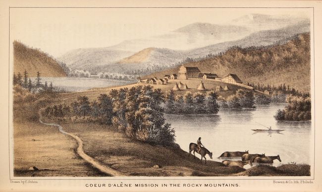
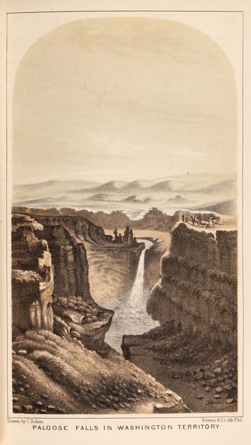
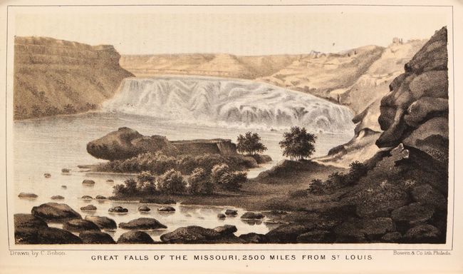
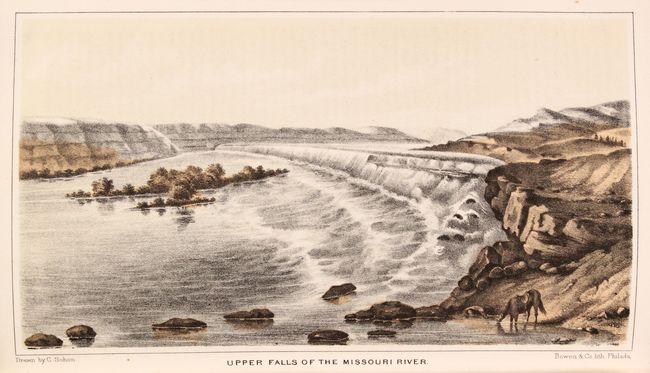
This important report by Captain John Mullan describes the construction of a military road connecting Fort Walla Walla with Fort Benton on the Missouri River. The purpose for building the road was to assist in moving troops to the various forts in Oregon Territory. Creation of a wagon road had the added benefits of aiding emigrants in their travels through the interior, as well as being used for transporting supplies for possible construction of a northern transcontinental railroad. This route, also known as the Mullan Wagon Road, was the most famous road ever constructed in the high Northwest, according to Wheat. Included with the 363 page report are 8 (of 10) beautiful chromolithographs by Gustavus Sohon and the following four maps showing the path of the road:
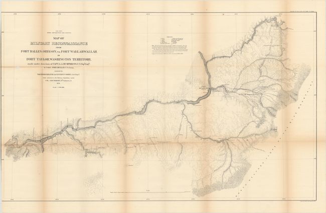
A. Map of Military Reconnaissance from Fort Dalles, Oregon, via Fort Wallah-Wallah, to Fort Taylor, Washington Territory... (35.5 x 21.3"). A highly detailed map from Fort Dalles to Fort Taylor. Provides rich detail of topography with contour lines at 100 feet intervals. Locates the Emigrant Road to the States (Oregon Trail), Whitman's old Mission, and the battle site with the Cayouses Indians. A key at top provides incredible detail of farms, camps, trails, forests, wood types, and more along the road. Condition: There is a small chip in an unengraved area to the left of the title, and several small splits at the fold junctions. (B)
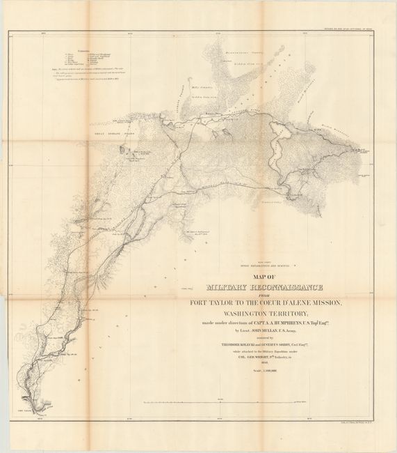
B. Map of Military Reconnaissance from Fort Taylor to the Coeur d'Alene Mission, Washington Territory... (20.4 x 21.6"). This map shows detail of the military wagon road from Fort Taylor to the Coeur d'Alene Mission, and presents the topography with an amazing amount of information. The map shows the expedition camps and locations of battles fought with the Indians during the survey. It is one of the earliest maps to show in detail the region that would become Spokane, WA and Coeur d'Alene in the Idaho panhandle. The farm and ferry of Antoine Plante is depicted. Plante, a French Canadian who came overland with the Astor party, settled in Spokane Valley near what is now the town of Millwood in 1849. In 1861 he received authorization to build the first ferry across the Spokane River. Condition: Light toning along the left fold with a 8" fold separation that has been closed on verso with archival tape. (B+)
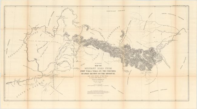
C. Map of Military Road from Fort Walla Walla on the Columbia to Fort Benton on the Missouri... (33.9 x 17.4"). This interesting map covers the country from about the 49th to the 45th parallel, so the Columbia River is shown as far up as the confluence with Clark's Fort. The Snake River is shown only as far as Lewiston, but Clark's Fork is shown in its entirety, as are Flathead River and Lake. The map provides great detail of the mining districts, numerous wagon roads, Indian Reservations, battlefields, forts, etc. Condition: Near fine with one tiny fold separation that has been closed on verso with archival tape. (A)
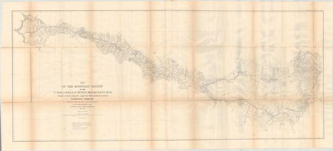
D. Map of the Mountain Section of the Ft. Walla Walla & Ft. Benton Military Wagon Road from Coeur d'Alene Lake to the Dearborn River Washington Territory (49.9 x 21.1"). This map is considered to be the most significant both from an historic and a technical viewpoint in this series. Historically important for the illustration of developments in the region; gold mines, locations of La Barge City, Johnny Grants and habitations of early settlers such as Dempsey, Barr and Adams. It is also a technical tour de force as it was the " first ... general map using the contour method to represent topography ... in the west" (Wheat). Condition: There are several small splits at the fold junctions and a few small spots. (B+)
363 pages. Rebound in faux quarter leather with tips over green cloth boards.
References: Wheat (TMW) #1077-1080; Howes #M-884; Wagner-Camp #393.
Condition: B+
See description for map condition details. Text and plates are very good with light toning and some color offsetting on the text pages adjacent to the plates. Modern binding is pristine.